Contact Us

Use the form on the right to contact us.


Maybe you have questions about upcoming products?

Maybe You have questions about a piece You saw on Our site?

Maybe You'd Like to know what shade of blue we use for the sky...?


123 Street Avenue, City Town, 99999

(123) 555-6789

email@address.com


You can set your address, phone number, email and site description in the settings tab.
Link to read me page with more information.

Ravenel_Bridge_at_night_from_Mt_Pleasant.jpg

Blogs and Such

Filtering by Category: David's History

Trippin´ Out

Brandon Joyner

I have had the opportunity to sing with different groups from an early age. My parents both played the piano when they were younger, but got away from it as adults raising five boys. There was little time and money to give for music lessons or a piano so my involvement with music was limited to the new youth choir at Citadel Square Baptist Church.  

I was about ten when John Hutto came to our church. I had some previous exposure to music lessons in school but only once a week when the teacher came to our school. She was shared with the other schools in our district. Once a year we had a variety show to display our talents and I got my first chance to be showcased in a round of square dancing. I forgot the steps and since then I have had a reluctance to be involved with dancing of any sort. I´m sure that impacted my social life significantly.  

Vocal music is, has been, and will always be the glue in my life that provides me interaction with others.  

I connected with my very first community theater production in the late ´80s. I had no idea what I was going to be involved with, but I was convinced I could do what I had seen so many others do. I was in for a big shock. I not only didn´t get the singing part I wanted; I was expected to dance in the role that I was assigned. Yes, I could have left that night without a part in the play, but that would have been failure to me. Long story short, the choreographer managed to get the director to minimize my dance moves to a bare minimum. I wasn´t going to be billed as a song and dance man for that show. 

Over the course of the next few years, I had the chance to appear in ¨Hello Dolly¨ with Robert Ivey as the director/choreographer and ¨Blood Brothers¨ with Linda Walker as the choreographer. I view both of these shows as lifetime memories simply to have had any part in them. I know that both these notable professionals were stressed to the limit while trying to chronic left foot syndrome. That notwithstanding, they let me stay in the show and dance through my scenes with far less movement than they had intended. 

Again, stardom or the chance to play Vegas had slipped off the stage. 

I guess at this time in my life I have to be satisfied with being an ordinary guy who will just shuffle across the boards and sing for my supper instead of tripping over the lights.  

Fantastic. 

~ David Joyner 

Middleton Gardens of Good and Evil

Brandon Joyner

(A Brief History of Middleton Place)

Middleton Plantation was home to noted generations of South Carolina’s Middleton Family. It is also the home of the oldest landscaped gardens in the United States.

The plantation house was begun in the 1730’s by John Williams, father-in-law to Henry Middleton who completed the house’s main section in its North and South flanks. Henry later served as President of the First Continental Congress (1774). His son, Arthur, a signer of the Declaration of Independence was born at Middleton Place and lived out his life there. Arthur’s son, Henry, and grandson, Williams, transitioned Middleton Place from country residence to an active rice plantation, thus earning the name Middleton Plantation. During the Civil War, most of the house was burned, leaving only the South wing and gutted walls. The Earthquake of 1886 finished the job and toppled the walls of the main house.

The restoration of Middleton Place began in 1916 when descendent John Julius Pringle Smith (not to be confused with John Jacob Jingleheimer Schmidt) and his wife, Heningham, began several decades of reclaiming the gardens. With the help of New York architect, Bancel LaFarge, they designed a stable yard-complex with buildings of brick salvaged from the ruined main house.

On November 11, 1971, Middleton Plantation gained its status on the National Registrar of Historic Places and later that year the Smith Family established the Middle Plantation Foundation.

Because of its renowned gardens, locals call it Middleton Gardens though it is now readily known as Middleton Place. The gardens, originally open to the public in the early 1870’s, include formal hedge rows that enclose a variety of flowers, plants, shrub and trees. Notable blooms include camellias, daffodils and azaleas among countless other species blooming year-round.

The most prominent features of the garden are the reflecting Butterfly Lakes and the Grand Live Oak, whose trunk boasts an impressive 10 feet in diameter. The Terraced Gardens and Butterfly Lakes lay East of the Main Residence. Today, this “last large-scale romantic-style garden” is home to much wildlife and welcomes many visitors from around the globe.

~ David Joyner

Dream Weavers

Brandon Joyner

A Brief History of Sweetgrass Basket Ladies

The art of sweetgrass basket weaving has been passed down from one generation to the next and is a craft learned during childhood. Much practice and patience are required to make these creative baskets and each artist has their own slightly different style. Sweetgrass or Mary’s Grass (scientifically named Hierochloe odorata or Anthoxanthum nitens) is aptly named in that when it is cut, it produces a sweet smell.

These sweetgrass baskets are made of several different kinds of grass—tan sweetgrass, thick dark bulrush and longleaf pine which is woven by long strips of palmetto leaves. Each basket is carefully and meticulously handmade and therefore creates a multitude of variations in size, shape and style which are seen throughout the Lowcountry.

These coiled sweetgrass baskets 1st appeared in the Lowcountry during the late 17th century and are historically significant examples of African cultural heritage transported to the Gullah Island from across the Atlantic. Originally, these baskets were used on plantations for agricultural purposes such as rice production and harvesting. By the 1980s household baskets were being created for use as well as decoration.

Today, sweetgrass basket weaving remains an integral piece of both artistic and cultural fabrics that make up Charleston and the entire Lowcountry, including the 7-mile stretch of Hwy 17 in Mount Pleasant designated as the Sweetgrass Basket Makers Highway.

Without the involvement of the entire family, including children, this legend could very well disappear as it is believed that only about two hundred families carry on the tradition. As such, it has become a family tradition where the men and boys will harvest as the women and girls create.

 One notable artisan in the field, Mary Jackson has brought worldwide attention to the art and is even displayed in the Smithsonian. She notes that it is the natural evolution of the baskets woven by her mother and grandmother. She brings unique contemporary touches to her pieces which sets her skill apart from many other weavers. It is her precision that makes her stand out and she shows much influence of her years in New York. She has been an immense influence on the sustainability of the grasses for many harvesters in a natural habitat. Together with help from conservationists and the city of Charleston, grasses have been salvaged to preserve the sweetgrass basket tradition. This led to the donation of land at McLeod Plantation where these plants can flourish and continue to grow for years to come.

Additional efforts have been made by other weavers to save this potentially dying art-form. Notably, Corey Alston, a fifth-generation weaver, with over 14 years in his craft. He has created a modern twist on tradition as he seeks to help keep the Gullah tradition and culture alive with his displays at the Charleston City Market. He created the 3D “Build Your Sweetgrass Basket” app which allows customization, cost and craft estimation all in one place. This is his way to keep the “dying artform and... this Gullah tradition alive through modern technology.”

~ Kristen N. Granet

On Egret’s Wings

Brandon Joyner

(A Brief History of the Snowy Egret)


When one thinks of Charleston, snow is not the first thing to come to mind. In fact, it’s quite the opposite. The same might be said about the snowy egret. It’s neither an egret nor does it like cold weather.

Originally mis-identified as such (Egretta thula) while the genus name is French for aigrette or aigron “heron” the species name thula, that of a black-necked swan, was applied in error.

If you were to go out into the waterways of Charleston, you might spot a medium-sized white bird. If you would like to identify said fowl as a snowy white egret, you would want to make sure that this heron was outfitted with a black beak, yellow lore (the tufts of colored “skin” between beak and feathers leading to the eyes), black legs and yellow feet. But, don’t be fooled, because during the breeding season of spring/summer, not only does the lacy aigrettes plumage grow in, but the yellow lore of the snowy white egret turns a tinge red, alerting each other of mating time. Upon first spotting, it is difficult to distinguish the male from the female as both genders are around 22-26 inches long (the male, typically slightly longer by mere centimeters at times) boasting a wingspan of approximately 40 inches.

While these birds can be found inhabiting mostly wetlands and aquatic areas—both fresh and salt water, coast zones in bays, marshes, lagoons and the like, egrets enjoy a varied diet of both land and sea! They can be seen noshing on fish, crabs, frogs, snakes, insects, worms, lizards, crustaceans and even rodents. Their shorter legs afford the snowy egret a much more active feeding style than birds of the same ilk with longer legs who practice a very slow-moving feeding style (such as the Great Egret).

They must forage in shallow or standing water, waiting for prey due to the size of their legs. The most common method of feeding practiced in the Lowcountry is thrashing; the snowy egrets stir up the bottom sediments to startle their next meal, sending it toward them. Alternately, they may be seen (in other areas of the world) in the grassy meadows and feeding in the open fields along with other large mammals—such as rhinos—who stir up the areas for them.

Snowy egrets breed in colonies with other herons. Their cacophonous cries around the nesting colonies are aptly juxtaposed with their soft, graceful exhibition. All in all, they’re “equal opportunity nesters.”

Nest sites are typically selected by the males who circle multiple times, displaying warning signals at high altitudes by pumping and pointing head and plumes, and then he nose-dives down to mark his claim on the perfect spot. The male collects twigs, grasses, and other materials while the female constructs it. The female will lay between 2-6 eggs and then they both share incubation duties. The young chicks are fed by both parents. When it comes time for emerging from the nest (a whopping 20-25 days later), it takes them about 5 more days until the young are able to fly.

Once, these delicate snowy white egrets were doomed for extinction, but now... they’re more prominent than ever and can be found residing in Mexico, South and Central Americas, the United States on the Pacific Coast and lowlands (as well as northern Nevada and Utah), along the Gulf of Mexico, southeastern states such as Florida and especially here in Charleston, SC!

Some might consider the Snowy Egret the “Goldilocks” of birds. They happily grace our presence with their elegant white plumage and go where the ecosystem will be a rich environmental habitat for them. So, if you just happen to peek out your window and see one of these beauties, know that your little slice of heaven is… just right.

~ Kristen N. Granet

Prisoner of Fortune

Brandon Joyner

A Brief History of Boone Hall Plantation

Located in Mount Pleasant, SC, this 470-acre land is one of the oldest functioning plantations in America and is listed on the National Register of Historic Places. 

Boone Hall Plantation, founded in 1681 by Major John Boone, originally gifted as a wedding present by Theophilus Patey to his daughter Elizabeth and aforementioned new son-in-law, is a symbol of Southern heritage. In 1743, Boone’s son planted two rows of live oak trees on either side of the main drive in toward the plantation home that we know today as “The Avenue of Oaks.” The Horlbeck family then took over the plantation and in 1850, 4 million bricks were produced at the hands of the laborers.

1935 saw the home acquired by Canadian couple Thomas and Alexandria Stone who believed that a wooden home wasn’t proper for a Southern plantation. Thus, in 1936, an antebellum era plantation home was built at the head of the drive and remains there to this day. With this change, the once 700-acre pecan farm was downsized to only 200 acres to allow for other new additions, including a self-sufficient power plant. And, in 1955 Mr. William McCrae and his wife Nancy acquired the grounds and focused their attention on maintaining more fruitful crops, such as peach trees, and on restoration, opening the home to tours in 1956.

The grounds underwent several transformations over the years not only in crop but also in format from cotton to bricks to pecans and even thoroughbred horses. Boone Hall Farms across Hwy 17 from the actual plantation and farm area sells produce directly to the community. Additionally, in front of the fields, they have added a produce stand under a tent. 

Throughout the seasons, Boone Hall transforms to accommodate different occasions. During the spring and summer months, several different crops are harvested, from the “you pick” strawberry fields to the rows and rows of peach trees. At Halloween, there is a haunted hayride that takes you through the forests on the grounds and even a haunted house. And then, at Christmas, the house is decked out in holiday apparel, tours of the plantation home and concerts are given in full antebellum costume. Many special events are hosted here annually from the Lowcountry Oyster Festival to Concert Series under the Oaks. The beautiful grounds have also proven to be backdrop for several movies, to name a c: North and South and The Notebook.

The moss-draped “Avenue” provides a beautiful backdrop for the many weddings held on-site. Additionally, the Cotton Dock, located to the left on the water just before the main plantation house, is utilized for rehearsals, reunions, parties, and smaller weddings alike. The facilities also offer daily tours of the house complete with the history of the land and families who resided there through the years.

Boone Hall Plantation is rich in the history of the Gullah peoples. This can be experienced first-hand by way of the presentation “Exploring the Gullah Culture.” This exhibition has been adapted from the stories of African slaves and presented live by actual Gullah descendants. They share theirs and their ancestor's stories, song, dance, and tradition demonstrating education through entertainment. Many have found this to be “very moving and emotional” as they tell the tales overcoming and rising above the hardships of the past that have brought them to the place they are today.

We know no better way to leave you than through the words of one of the Boone Hall Gullah Presenters:

“We must leave the divisiveness of the past behind in order to move forward and claim the future.” ~ Ms. Gloria Ford  

~ Kristen N. Granet

All Hands on Deck

Brandon Joyner

(A Brief History of the Hunley)

Whether it is specific history or history in general that you seek, few items hold the significance that the CSS Hunley does.

Not only is it significant to Charleston because it was the sight of its singular mission, and the resulting rescue and display, but it is formidable in its place in modern warfare. This was no easy task because in the effort to develop and build this craft much drama occurred. Multiple models and working prototypes were built and put to sea with both loss of product and loss of life (two versions of the Hunley sank with hands on board before the third was put to sea).

The efforts of multiple designers, builders and investors began in New Orleans, LA, in 1861. Mr. James Mcclintick and Mr. Baxter Watson began the development of a three-man underwater boat in the late fall of 1861. Horace Hunley joined them and added his expertise to theirs. They succeeded in creating two more crafts that eventually failed to satisfy the underwater testing. The inventors had to scuttle their second craft during subsequent trials due to the fact that the union forces had begun their siege of New Orleans, which forced them to flee to Mobile, AL.

With their plans in hand, they began to put together their third prototype which eventually became the CSS Hunley. Together with multiple new investors and the confederacy supporting them, they launched their efforts. After demonstrating that their submarine could pull a charge behind it, then dive towing the charge into its target and sinking it, and then resurface safely

beyond the target; the CSS Hunley was transported by rail to Charleston, SC for its ultimate use there.

The Hunley was being put through sea trials by Mcclintick after it arrived in Charleston, but it was seized by the confederacy because of the slow pace of readiness. On August 29th, 1863, the Hunley sank at the dock with several reasons being offered for the cause. Five crewmen died. During the ensuing months. Horace Hunley arrived in Charleston and demanded the return of his vessel. It was found and then hoisted from the bottom then refitted. Hunley then recruited a new crew which included himself. In October of the same year, a second test run was initiated with a second failure and with all hands lost. It appeared that someone forgot to close the seacock valve or lost the wrench needed leaving them unable to save themselves. Because of the two failed efforts, Union spies in Charleston learned of the new war machine and began developing anti-submarine measures which are still in use today.

Confederate general Beauregard reluctantly allowed lieutenants Dixon and Alexander both proponents of the project to move forward. They saw the need to modify the weapons delivery mode because their own intelligence informed them of the union understanding. General Beauregard demanded that they operate only on the service and therefore added urgency to the change that placed the torpedo on a spar which extended from the bow and would need to be rammed into the hull of the target vessel.

In February of 1864, the Hunley set out into the harbor on its first -and last- official mission - the sinking of the USS Housatonic. The rest as they say is history...

So, 150 plus years passed with numerous attempts made to locate the Hunley until in 1995 when a team with highly sophisticated sonar equipment and submersible vessels pinpointed the wreck. In 2000, a team of maritime recovery experts and historians began the recovery process with millions watching the broadcast.

Many years later, the submarine is still being probed and prodded for any clues as to why it sank on that fateful February night in 1864. There are several strong theories but no definitive answers without some communication from the eight men on board.

~ David Joyner

Heroes In a Half Shell

Brandon Joyner

(A Brief History of the Sea Turtle)

We won't tell you to "Just keep swimming…" or "Ride the E.A.C." or even speak in a surfer accent. What we will say is that sea turtles are sometimes referred to as marine turtles —species: Testudines chordata— and are not confined to one single area of the ocean but instead take on the motto that "the entire world is, in fact, theirs for the taking" (save for the extremely cold waters of the Antarctic and Arctic).

The reptilian name of "sea turtle" actually encompasses 7 different kinds of turtle: leatherback, loggerhead, Kemp’s ridley, green, olive ridley, flatback, and hawksbill. Though there are several differences between these types, the backs of the turtles that we refer to as “shells” are made up of hard, thick plates called scutes. The only exception to this is the leatherback whose carapace is soft, flexible and slightly rubbery. Turtles can vary in size between 2 feet to 7 feet long and range between 70 to 1500 pounds depending on the exact type.

How are do these guys come into existence, you may be asking yourself?

And, have we got the story to shell out to you! These swimmers migrate up to 3,700 miles each way, mating at sea. All the while, the female turtle selects the perfect beach for nesting, typically somewhere tropical. The temperature of the sand determines the sex of the sea turtles with cooler sand producing a male and warmer giving way to a female.

After selecting the spot where she can lay her clutch of 2-7 eggs, she buries them in the sand and then returns to the ocean. Anywhere from 6 to 8 weeks later, tiny hatchlings will peck their way out of their shells, writhing their way to the surface of the sand.

Soon after working their way up, these little sea turtle hatchlings then make their journey toward the shoreline and on to the waves of the big blue. But, not before being forced to dodge every possible predator one might imagine, including but not limited to: humans, dogs, raccoons, fire ants, lizards, coyotes, wild hogs, and even birds.

Once in the ocean, despite being rapid swimmers—in part due to their webbed feet, they are faced yet with even more predators: sea birds, dolphins, jellyfish, and many carnivorous fish. When not worrying about escaping, they enjoy the liberties of feasting on the sea around them: most turtles turn to algae and marine grasses while loggerheads dine on mollusks.

These turtles can survive anywhere between 50-100 years with the common lifespan of 80 years. Unfortunately, it is rare to see them live this long (the odds of making it an entire lifetime is one in a thousand). Most species are endangered as they are slow to mature and many times before procreating are unintentionally captured or killed by fisheries or the aforementioned predators.

Many rehabilitations centers exist for turtles that have been harmed. If you’d like to adopt a sea turtle, most sites will allow you to do so. The South Carolina Aquarium here in Charleston, SC has a Sea Turtle Care Center which will allow you to become a sea turtle guardian while they’re on the mend.

So, next time you hear the phrase “Lights Out,” this might bring new depth of meaning to you so that you can aid in allowing the turtles to find their way safely to the ocean after hatching and providing them a better chance at survival in the great blue beyond!  

~ Kristen N. Granet

Arthur in the Sky with Diamonds

Brandon Joyner

(A Brief History of the Arthur Ravenel, Jr. Bridge)

Since the beginning of time, new has replaced old. This isn’t any different when it comes to getting from place to place which includes the structures needed to get there. The Cooper River Bridges were in use for nearly 80 years connecting Downtown Charleston to Mount Pleasant.

The traffic flow on US 17 from Charleston to Mount Pleasant and back again could no longer be supported by the deteriorating metal beams of the older bridges. And thus... a new bridge-child was born: The Arthur Ravenel Jr, Bridge. This new bridge was named after the Senator/ Congressman with the plan to raise enough money to make Mount Pleasant Mayor Harry Hallman’s dream a reality.

The ARJ Bridge was erected with Skanska as the managing partner and Parsons Brinckerhoff as the lead bridge designer. The project was meant to portray double diamond-shapes to compliment Charleston’s harbor which teems with boats and sails. Construction was completed in 2005, 1 year ahead of schedule, and opened to the public on July 16th—only 48 months after beginning the project in 2001. The Ravenel Bridge has won many prestigious awards both nationally and globally due to its incredible style, structure, and its savvy green footprint.

The ARJ Bridge in numbers--

It’s the #1 way to reach the #1 City in the World—1 of the longest cable-stayed spans in North America; 2 diamond towers, clocking in at 2.5 miles long; earthquakes under 7.4 on the Richter scale won’t down it; supporting more motor vehicles with 8 lanes plus a 12-foot-wide path added for pedestrians and bikers; erected by more than 40 cranes and raised to 186 ft above the average high-tide mark (which allows for larger import ships); able to withstand 300 mph wind gusts, it stands a wee bit under 573 feet tall; built with 40,000 tons of structural steel and 50,000 tons of reinforcing steel; made up of about 300,000 yds3 of concrete overall; costing just about $650 million dollars in total to bring it to life!

Some refer to the Ravenel Bridge as Charleston's signature bridge, which is a literal statement of the obvious—many of the workers, builders, engineers, and the like have put their signature (in name and hand-print or carving) on this architectural diamond phenomena.

At times the cables can play tricks on the eyes, seeming to disappear on one side only forming a right triangle, but as motion continues, shifting back to the right, the other side returns to focus. Driving under the bridge’s diamond tower and looking up through a sunroof or out of a window is also a neat architectural treat.

To this day, approximately 40,000 people gather on the first weekend of April every year for the 10K Cooper River Bridge Run. The trek begins on Coleman Boulevard in Mount Pleasant, heads over Shem Creek, leads up into the sky, runs under the diamond pyramids and then into historic downtown Charleston complete with a party at the finish line.

We can’t think of a better way to experience all of the sights, sounds, smells and tastes of Charleston in one weekend! But, even if running or walking isn’t your cup of tea, there are many places to drink in this beauty from all angles throughout Charleston!

~ Kristen N. Granet

Just Around the River Creek Bend

Brandon Joyner

(A Brief History of Shem Creek)

tavern-stable-shem-creek-charleston-sc-located-mount-pleasant-south-carolina-53709110.jpg

From above, the water twists and turns through the landscape of Mount Pleasant like a long-forgotten blacktop in the vein of Route 66. This flowing freeway is called Shem Creek. Shem is based on the word “shemee” which is a Sioux term of unknown meaning, lost to the sands of time.

Long before it was settled by any European group or the like, Shem Creek was inhabited by a tribe of Eastern Sioux named the Sewee. When the 1670s arrived, the town that would eventually become known as Charleston was established and trade with the Sewee tribe was profitable.  At least it was for the English who came to settle there...

Captain Florence O'Sullivan – the man for whom Sullivan’s Island was named – was the first person who was granted land in the area. He would change the name of the land from Shem Creek to Sullivan’s Creek, in fact. It would eventually be passed from owner to owner adopting their surnames year after year. It was even named Distillery Creek for a short period of time when a distillery was built and functioned in the early 1800s. However, during this entire time, the original name of Shem Creek remained as well.

And then? The entire area was soon to be industrialized by that day’s standards.

In the 1740s, Peter Villepontoux owned a lime kiln utilized for the ever-exciting process used to produce quicklime. If you wanted something a little more festive, a distillery was also located on the Creek. Not to mention the other mills and factories that littered the area.  The ebb and flow of the tides would be harnessed by Jonathan Lucas. In 1795, he would construct the first water-driven combination rice and saw mill in Charleston.

This wouldn’t be the last time the tides would bring these bountiful businesses to the shore. Because of the deep water of the waterway, shipbuilding was the perfect fit. This would define Shem Creek in the 1700s and the 1800s. Boats were constructed and sent out to sea as quickly as they were able. Nearly 300 years later—in 1990-- E.O.  Hall’s shipyard shuttered its doors.

If you were sending ships off into the horizon, then some would, of course, be back. Shrimping and fishing were a huge part of the economic culture of the area at the time and remain so to this day. A man named Captain William C. Magwood would introduce shrimping to the area trawling onto the scene in his vessel, the Skipper. By 2011, there were less than a dozen shrimp trawlers on the Creek due to the rising costs and lack of dock space.

If you were to ask anyone today what does Shem Creek have to offer, they would probably tell you: Food, glorious food! A series of restaurants litter either side of the waterway just off of Coleman Boulevard. Each vying to offer the most delicious seafood feast. Each working to pour the most sumptuous libations.

What the future hold for this picturesque postcard of a place? That is where the waters get a little murky – Pun intended—be it building parking garages so more people can enjoy the sights and sounds or leaving it be to keep its original charm... Whatever lies just over the horizon for Shem Creek, you can be sure that the people of Mount Pleasant will take care of their little piece of heaven just East of the Cooper.

~ Brandon L. Joyner

Tie a Yellow Ribbon Round the REALLY Old Oak Tree

Brandon Joyner

A Brief History of the Angel Oak

Whatever it is, the way you tell your story online can make all the difference.

Whatever it is, the way you tell your story online can make all the difference.

It wasn’t until the late 1600s that English settlers, most that had migrated from the Barbados area, came to what would become the Charles Towne colony. In the grand scheme of things, this seems quaint in comparison to the historical natural sites modern Charleston is known for today.

The Angel Oak is one of those natural phenomena.

Standing at a height of 65+ feet with a spread of 160 feet, some estimate the Angel Oak to be between 400 and 500 years old, while others estimate the age to be around the Biblical age of almost 1500 years! This means that the Angel Oak is the oldest tree in the South – or at least, the Southeast – Right?

Well… Don’t let the gray hair fool ya!

There are other such photogenic photosynthetic flora in the Southeast that are rumored to be as old if not older than the Angel Oak. Several bald cypress trees scattered throughout North and South Carolina have been discussed to be older by several hundred years. None with the personality of the Angel Oak.

Yet, what’s in a name?

Southern Live Oaks, or as they are known in some circles, Quercus virginiana, are prevalent throughout the lowlands of the Coastal Carolinas.  But why is the Angel Oak called the “Angel Oak?” The answers may surprise you.

A total of ninety-six acres on modern-day Wadmalaw Island, the original land on which the Angel Oak grows was granted to Abraham Waight on July 25, 1717. Passed on to one of his ancestors Justus Angel and his wife Martha Waight Tucker Angel, the land was then known as Angel Plantation. The Angel Oak then adopted the same name.

The second namesake of the Angel Oak is much more spectral. Ghosts of the slaves who died in and around the area might be seen as the sun sets behind the horizon… floating, never to find peace...

There are times, however, the Angel Ois simple known as “The Tree.”

Like so many things in Charleston and the outlying areas, the Tree took a beating during Hurricane Hugo in 1989 and was severely damaged. Prosper and recover and then continue to grow the Tree did, even being purchased as part of a deal with the City of Charleston in order to preserve the oak and the outlying areas creating Angel Oak Park.

But progress will not and cannot be stopped. As recent as 2012, land close to the Angel Oak was proposed to be developed as an apartment complex less than 160 yards from the miraculous natural superstructure. Thanks to the dual efforts of Save the Angel Oak and the Coastal Conservation League, they were successful in the courts to thwart this invasion to the oak’s habitat. Hopefully, this will continue in perpetuity.

Its branches, reaching from the past into the future, the Angel Oak is a deep-rooted reminder of the grace and beauty that nature has to offer when allowed to thrive and prosper.

~ Brandon L. Joyner

That’s No Moon

Brandon Joyner

A Brief History of The South Carolina State Flag

Whatever it is, the way you tell your story online can make all the difference.

Whatever it is, the way you tell your story online can make all the difference.

Upon first glance, it is easy to assume our beautiful state flag is that of our state tree and what other than a perfect crescent moon (as it’s often photographed as such). However, did you know that—in fact—it's not a moon that rests upon the Palmetto State flag at all?

Before the flag you know and love today was solidified—at least in our minds, there were several different iterations of the SC state flag.  From a white ensign with green palmetto, a blue canton with a right-facing crescent moon, golden palmetto encircled with a white background to a white palmetto on a background of blue. The colors, designs, shapes, and sizes have varied drastically throughout the years.

Adopted on January 28, 1861, by the General Assembly, the South Carolina State Flag is the original design of Colonel William Moultrie from 1775. The SC State Flag is notably the oldest state flag in the United States and was originally slated as a National Banner during the Civil War.

There are several components of historical significance that make up this bold, blue, waving beauty.

Royal Blue Color—this rich blue matches the color of the soldier’s uniforms donned during the Revolutionary War. 

 The Palmetto Tree—the palmetto was used during the British attack at Fort Moultrie on Sullivan's Island. Colonel Moultrie used the resilient palmetto logs to build a fort that would not only withstand the impact but provide a “bounce back” to protect his soldiers.

And, the final missing piece of it, displayed in the upper left-hand corner of the flag... Is it a moon, a crescent, a gorget, a warning, an emblem? There has been much debate over what it is exactly.

The Symbol—looking very suspiciously like a crescent; a moon.  This was, in fact, the same shape of the silver emblem that was emblazoned on the caps of the soldiers which read: “Liberty (or Death)!” A signal fashioned to let Charleston know when and if the British were coming during the Battle of Sullivan’s Island.  According to Roger Stroup (historian) & Dr. Eric Emerson (SC State Preservation), Col. Moultrie’s diary says the design is “simply ‘a crescent.’”

To this day, “specifications for shape, size, design & placement” of these symbols—even the exact color of background—haven't been standardized by the South Carolina Senate.

So, what the future holds for the SC Flag—who knows? You might see this beautiful flag designed by Jeannie Joyner being flown one day in the near future!

~ Kristen Granet


Bright Lights, Bigger City

Brandon Joyner

(A Brief History of The Morris Island Lighthouse)

7f9fb58ec38bb6357f54a28e47885601.jpg

One of the great things about living along the coast is the fascination and love of lighthouses. When you see one for the first time, the idea that somehow, we humans had the foresight to know how important this simple fixture would affect the safety of mankind upon the waters of the world is amazing.

Here in Charleston, we have two lighthouses—one that is officially the “Charleston Lighthouse” and one that has been the “Charleston Light” for better than three centuries. Of course, the latter has had almost a cat’s number of lives in its long history.

From 1673 the first light burned at what was then only the Charles Towne colony. The construct of balls of oaken and pitch elevated in iron baskets was replaced in

1767 with a 42-foot-tall tower which held lamps of lighted fish oil suspended from its ceiling. Having known the smell of raw fish oil, I wouldn’t want to have been the keeper of the light during that time. This more permanent structure was situated on three small Islands known as Middle Bay Island. It also had the distinction of being the first of the pre-revolutionary lights built in the Carolina colony.

The “Charleston Light” has served the city well during its lifetime. In 1775, the light was darkened to prevent the British from entering Charleston Harbor safely. Shortly after the Revolutionary War, the Tower of 42 ft was replaced with a brick tower which rose above its foundation to a height of 102 ft. A newer light reflector system was installed making the light even more effective. In 1790, the South Carolina legislature (in its infancy) transferred the title for the light to the newly-formed Federal Government. The three small islands that formed Middle Bay Island had accrued enough sand and substance to now be one Island and the name was changed to Morrison's Island. Charleston had also grown to be the largest commercial East Coast port just behind the port of New York.

As the port grew, the town grew and so did the importance of the light. In 1800, Congress appropriated monies for repair and upgrade; by 1838, the light had been improved to a revolving light. In 1858, a newer, first-order lens was installed to provide an even stronger presence on the coast.

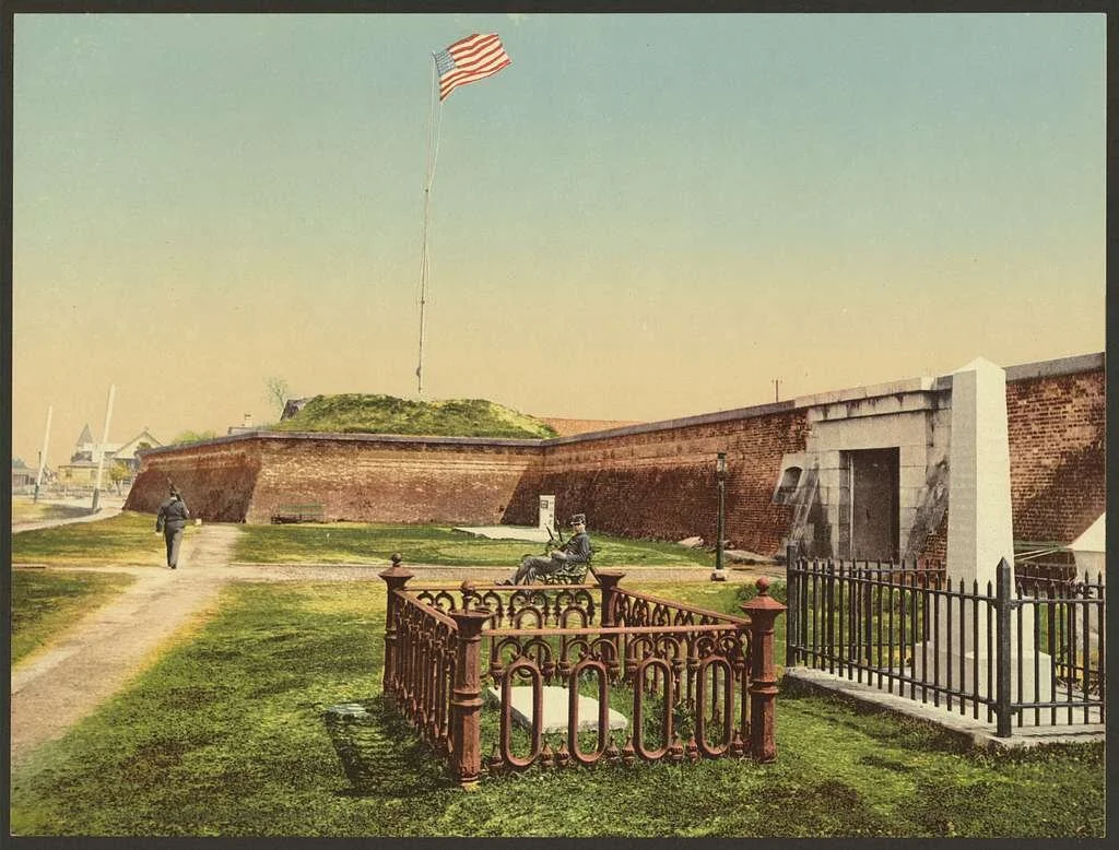
The lighthouse on Morrison's Island had become so significant that upon secession of South Carolina from the Union, the Morris Island Lighthouse was wrested from the Union by the Governor’s order and demand that the lightkeeper leave the light and the state due to its forcible possession. The importance of the light did not keep the Confederate forces from destroying the lighthouse to prevent the Union Navy from easy access to Charleston Harbor or the Union Army from using it as a lookout tower.

After the war in 1873, Congress approved funds for the construction of the Morris Island Lighthouse which was first operated in October of 1876. Towering 158 ft above the ocean, the light penetrated the darkness of night 19 miles out to sea. At the base of the round lighthouse tower stood the lightkeeper's house and a boathouse. During the late 1800s, a number of significant things happened to or had deleterious effect on the lighthouse and its accompanying buildings.

Earthquakes in 1868 and 1886 damaged the foundation of the light and moved the refractive lens mount in the tower. A massive hurricane in 1885 destroyed the rear beacon; overturned part of the base wall and carried away the bridge between the two beacons. The wooden walkway that connected the island’s structures were badly damaged and the boathouse was overturned. This version of the lighthouse had only been in place since 1876 and had grown to 161 feet in height.

Another significant negative event in the life of the Morris Island light was the completion of the Charleston Harbor jetties in 1889. The structures were built to protect the channel into the harbor, but they caused shifts in the current which eventually eroded the island that surrounded the light. Once, almost 1,200 feet from the water's edge, the ocean finally surrounded the base of the lighthouse tower which stood alone in pictures as early as 1938.

By 1962, the automated lighthouse was deemed unsafe and impractical as a manned tower. It was decommissioned and subsequently replaced by the Sullivan’s Island light that same year. -

The Morris Island Light is now 1600 feet from shore completely surrounded by ocean waters. Its base has been reinforced by concrete via the efforts of a group of Charleston locals’ determination to “Save the Light.” It’s now owned by the state of South Carolina but leased to the “Save the Light” Foundation.

In 1989, Hurricane Hugo washed away what was left of any remnants of the contingent buildings and caused erosion which leaves the lighthouse sitting alone in the ocean.

Many Charlestonians and lighthouse enthusiasts still dream of the renewal of the Charleston Light known as the Morris Island Lighthouse. It has such a strong following that in the parking lot of Myrtle Beach’s Broadway at the Beach shopping complex, stands a 109 ft replica.

In even more exciting lighting news: for the 2019 Fourth of July weekend, “Save the Light” Foundation partnered with Dominion Energy to turn on the Morris Island Lighthouse in celebration of Independence Day. This celebration was just the beginning to light the fire for their $7 million restoration project which will take place over the next 5 years.

So, all you Lighthouse enthusiasts out there need not despair... The Charleston Light is awaiting repair!

~ David Joyner and Kristen Granet

A Beautiful Faith Lift

Brandon Joyner

(A Brief History of St. Philip’s Church)

St._Philip's_Episcopal_Church_in_(Charleston,_South_Carolina).jpg

Up the coast a little way, located in Hampton, Virginia, sits St. John Episcopal Church established in 1610. While there were older Christian congregations, this was the first time that English was the primary language spoken. St. Philip’s Episcopal in Charleston would become the second. 

A group of settlers would disembark near the now-defunct Albemarle Point in the early 1670s. They would eventually make a life for themselves between the Ashley and Cooper Rivers around 1679. Forming a more religious coalition called “the English Church,” they were officially known as St. Philips.  

While the congregation first gathered in 1680, the first physical structure was built between 1681 and 1691. Between Broad and Meeting Streets, Originall and Millicent Jackson donated four acres of land where the structure was erected. Made of black cypress with a brick foundation, this “large and stately” church would sit on this spot for nearly two decades until a hurricane would irreparably damage the original building. 

This is where things get a little fun…

Where St. Philip’s sat at the time would become the future site of another iconic church named St. Michael’s. Just a couple blocks over on Church Street, a new church under the name St. Philip’s was being constructed in 1710 and completed in 1723. But even this structure wasn’t long for this world as it burned down in 1835.  It was rebuilt on the same spot (this time) and neared completion in 1838 – the year of the great Charleston Fire!

Due to its size, the city was forced to design Church Street with a large curve around the projecting tower and steeple. The towering steeple was designed by E.B. White and added to the church in 1850.  Between 1893 and 1915, a beacon was attached to the steeple and was utilized as a lighthouse to guide ships in the Charleston Harbor. 

Many prominent priests would preach from the pulpit. From Reverend Thomas Frost to John Wesley. From George Whitfield to the founding President of the College of Charleston, Rev. Dr. Robert Smith. George Washington himself even worshiped there at one point. 

Famous people don’t just flock to this gorgeous construction inside, however. Vice President of the United States, John C. Calhoun, President of South Carolina from 1778-1779, Rawlins Lowndes, and playwright Dubose Heyward of “Porgy” fame are all buried in the graveyard surrounding the church.  Being such an important part of Charleston’s history, it wasn’t even added to the National Register of Historic Places until 1973. 

From 1993 to 1994 the church would go through its most recent restoration, the congregation worships in the building as it stands to this day. 

Despite so many disasters -- the original church bells being melted to create Confederate cannons, earthquakes nearly destroying the building, Hurricane Hugo causing 4.5 million dollars in damage – St. Philip’s still stands today as a reminder of the resilience of Charleston and the Lowcountry.    

~ Brandon L. Joyner

Deconstructing the Construction

Brandon Joyner

(A Brief History of the Old Charleston Cottage House)

My Post.png

The streets and homes of Charleston, SC are a living, breathing thing. Down every alleyway and every street, a story screams from the cobblestones or seeps from the entryways in so many of the structures in and around the downtown area. Charleston has stood through the Revolutionary and Civil Wars and many of the buildings that were standing during those times are still around today to tell us first hand of the past.

What might surprise you is that Jeannie Joyner, an artist from South Carolina, has created a design drawn from her experiences here in town.

While today the doors of homes might feel a little lighter, walking down King Street you’ll notice that there are no small balsa wood entryways. They are lumbering, castle-like massive structures. The Old Charleston Cottage also was designed with oak or mahogany double-doors representative of buildings that have vacillated between residential and commercial in the last 400 plus years.

Most of Charleston’s French Quarter was destroyed by a fire in 1740. The original Dock Street Theater was ruined along with many other buildings. Rebuilt and re-established as the Planter’s Inn (arguably home of the world-famous Planter’s Punch), it returned to the purview of the City of Charleston in 1935 after it was scheduled for demolition. Repurposed yet again into the Dock Street Theater, the clay brickwork peeks through at the casual passersby on the road. The Cottage House mimics these accents that are prevalent throughout so many of the oldest homes in Charleston.

Since most of the houses in the downtown Charleston area are among the oldest in the country, they were originally constructed without central heating and air. During the long, hot, extremely humid summers, many residents would be forced to keep all windows open for air flow in order to avoid roasting themselves to death. But if a rainy day were to come along, the lintels above the windows might provide a few crucial seconds for everything to be shuttered and not ruin the hard wood floors. Or maybe they could leave them open!

On Queen and Meeting Streets, you’ll find that since the houses in the area have almost no yard, the best way to display someone’s green thumb is with a flower box. The residents of these homes and so many in the area fill these boxes with tall, flowing and, cascading flora to show off their individual style while respecting the general feel of Charleston. It’s only right that our painted House would do the same.

Above the windows of the Cottage House, keystones are prominently displayed. These capstones are placed for both decorative and functional purposes on many Charleston homes. They provide support for the weight of the structure above while completing the window header for the intersecting arches. In short, it's pretty but purposeful.

If you were to approach anyone who’s been to Charleston and ask them what is THE Charleston landmark, most would probably tell you Rainbow Row. In the early 20th century, one of the property owners on East Bay Street chose the Caribbean Pink exterior to help cool the house during the Charleston summers. The other owners next door followed suit with vibrant pastel colors of their own choosing, thus giving us what today is referred to fondly as Charleston’s Rainbow Row. Much of the color palette of the Old Charleston Cottage House was chosen to mimic these gorgeous façades.

The earthquake bolts, shutters, hitching posts, shutter latches, even the mail slot is representative of so many houses in the downtown and surrounding Charleston areas. The elements have been added after hurricanes and earthquakes as they have been proven to be necessary editions.

It might be trite to say that, to an artist, the world is their canvas. In this specific case, it’s quite true. Jeannie has amalgamated her own past and the history of her hometown and has created something truly special. She’s imagined a cottage from an idealized yesteryear for generations in the future to share.

What the Old Charleston Cottage House design accomplishes is bridging a generation gone to another that has not yet come into being.

~ Brandon L. Joyner

Grab Your Coates and Get Your Hat

Brandon Joyner

circa-1865.jpg

Finding history in Charleston is like finding something sweet in a candy store. Everywhere you look you find another visually tasty morsel.

Coates Row, however, is not one of those tidbits that locals boast of when prompted only because it has been what it is throughout its existence.

Depending on which you hold to be more accurate, the structures were built either in the 1680’s or shortly after Thomas Coates saw fit to purchase the property in the late 1780’s. Either way, the story remains the same - the properties are the oldest commercially used set of storefronts in Charleston, due to the fact that they are still open for business to this date.

Since their inception, Mr. Coates decided to allow multiple businesses in the group of buildings housed at the addresses between 114-120 East Bay Street. With little to no reference - without extensive research - there is miniscule mention of much else beside the taverns either initiated by Mr. Coates or by his wife, Catherine.

The first was the Harris Tavern, later renamed the French Coffee House, due to the regularity of the gathering of the Jacobin Club (French American immigrants aligned with the French revolutionists). The possibility that the activities of these particular individuals contributed to the American Revolution or its activities would be speculation, but many colonists looked with favor on the happenings in France. Significant among their membership was Robespierre who led the club as president. However, there is no indication that neither Mr. nor Mrs. Coates were associated with this group of revelers.

Mrs. Coates decided to try her hand at handling the bar. This experience prompted her to open her own java inspired establishment, The Carolina Coffee House. Other names

for the two taverns operated by the couple included Tavern on the Bluff and Mrs. Coates Tavern on the Bay.

Through the years, the names of these buildings went through many changes. It is probable that the multitude of varying nomenclature originated due to the close proximity from wharf to drink. The large number of sailors frequenting the taverns while waiting for their ships to arrive or unload or load, each swabby remembered the pub and its name in their own groggy way.

The current group of retail stores does include one of Charleston´s more well-known alcohol shops, the ABC Package Store.

So, however you color it, as much as things change, they still seem to have some semblance of the same at the keg’s core.

~ David Joyner

The United States Supreme Fort

Brandon Joyner

(A Brief History of Fort Moultrie)

fort-moultrie-charleston-sc-a167d9-1024.jpg

Sullivan’s Island, home to Fort Moultrie, has served throughout history by protecting Charleston’s Harbor as the first line of defense against invasion, both in force and health. Fort Moultrie, once boasting 5.3 acres of seafront defense, is located between Stations 14 and 16 ½ (from Middle Street to Thompson Avenue) with the official address of 1214 Middle Street.  

One of the original log cabins and first of known forts on the island, Fort Moultrie (at the time known as Fort Sullivan) was initially constructed of Palmetto trunks and sand under the supervision of Captain De Brahm. It was not yet even fully formed when it was first attacked by the British warships in 1776. The fort was slated, in square design, to have 10-foot-high rows of palmetto logs in parallels, but at the time only stood 7-feet high with corner bastions and cavaliers along the rear walls. 

Despite its incomplete state, in the Battle of Sullivan’s Island, Colonel William Moultrie and his men fortified the island and stood their ground, saving Charleston (then, Charlestown) from British occupation. Throughout British occupation, from 1780–1782, the fort was known as Fort Arbuthnot. During this battle, Moultrie flew a flag of his own design, authorized by the colonial government – later called the Moultrie or Liberty flag – which became iconic to the Revolution in the South. Charleston locals celebrate “Carolina Day” to commemorate the bravery of the defenders of the fort. 

In 1793, war broke out between Great Britain and France. The Congress, seeking to safeguard American shores, authorized a second Fort Moultrie to be built. The fort was finally completed in 1798, but then suffered from much neglect. And, then, in 1804, it was destroyed by the Antigua-Charleston hurricane. 

It wasn’t until 1809 that this fortification, undergoing it’s third rendition, was finally completed, though very little changed from its original design-build. In the 1820s the fort began to record meteorological observations. Then, post secession, in December of 1860 it was abandoned when Union soldiers fled to the stronger structures of Fort Sumter. 

On April 12, 1861, at 4:30 AM, Confederate flares fired upon Fort Sumter and thus began the American Civil War. Fort Moultrie was severely damaged. Post surrender of Fort Sumter, Confederate forces used Fort Moultrie to protect Charleston’s harbor until February 1865 when they fled the city, again leaving the fort behind. 

Once the American wars ended, the fort was repaired and modernized by the Army for use during WWs I and II with additions of concrete bunkers to this coastal defense system. A comprehensive upgrade of the fortifications of the entire US coast were implemented with the outbreak of WWII. More batteries were built along the coast, including the BCN 520 (Battery Construction Number) at Fort Moultrie’s stronghold, which were armed with guns previously used at Battery Kimble in Galveston, TX. 

Then, in 1947, on August 15th, Fort Moultrie’s flag flew for a final time, thus ending its years of service in defense of the US as it had become obsolete with the advent of nuclear weapons and guided missiles. 

In 1960 the fort was decommissioned by the DOD and became part of the National Park Service as Fort Sumter and Fort Moultrie National Historic Park, boasting the only location that the entire defense history is traceable by the NPS. And, on September 6, 2007 all of its 171-year history was added to the National Register of Historic Places. Today, the Harbor Entrance Control Post has been preserved and the BCN 520, still remaining from WWII, is now a private residence. 

While we wouldn’t recommend knocking on the door to 520 for a behind the scenes tour, the visitor’s center at the fort features a mini-museum and shows a short film on the history of Fort Moultrie that many enjoy daily! 

~ Kristen N. Granet

~

Going To the Chapel

Brandon Joyner

(A Brief History of Summerall Chapel)

Summerall_Chapel.jpg

Sitting in the heart of the Citadel on the Avenue of Remembrance, this cruciform chapel is a testament to many. It serves not only the Citadel but also the South Carolina Corps of Cadets as well as the Charleston community.

Being non-sectarian, non-denominational, the chapel hosts weekly worship services also that are specifically Catholic, Protestant, and Episcopal. Throughout the year, many special events are held inside from weddings to the Christmas Candlelight Services to name a couple.

Designed by C.R. MacDonald, chapel construction began in September of 1936 and was completed merely one year later. On Palm Sunday of 1938, the chapel was dedicated simply as the Cadet Chapel. After Gen. Summerall’s retirement as president in 1953, the name was changed to Gen. Pelot Summerall Chapel.

Thirteenth and Fourteenth-century Gothic-styled architecture, oaken furniture, and ceilings of pine are prominent in the building’s design. Many stained-glass windows depicting the life of Jesus Christ adorn the chapel.

Medallions have been provided by families and friends of many commemorated cadets which make up the façade and transept windows. Each medallion is identical in size, but represents the specific individuals symbolically based on “courage, sacrifice, religion, truth, duty, loyalty, patriotism, faith, charity, prayer, adoration, praise, and immortality.” The chancel window behind the altar was dedicated in 1942 to all Citadel graduates who lost their lives courageously fighting for the country’s cause.

There are 57 flags on display in the chapel; this includes the flags representing each of the states of the union which not only hang throughout the chapel but also improve the acoustics within.

Summerall Chapel is well over 80 years old and the magnificent stained-glass windows have begun to show some wear and are in dire need of refurbishment due to their age. In 2019, the Class of 1974 launched a campaign to assist in such repairs. In addition, the Citadel Foundation has supported the formation of an Advisory Committee to further these efforts of restoration with a target completion of 2023.

Words of reflection are inscribed at Summerall Chapel-- Above the altar reads: “To the Glory of God, and In Memory of The Citadel’s Patriot Dead” and outside the chapel on the ground reads: “Remember Now Thy Creator in the Days of Thy Youth.”

Summerall Chapel is a place of remembrance, patriotism, religion, and prayer where all may come together in reverence to reflect and worship. It is a place of sanctuary, a stronghold, a safe place for not only cadets but all to commune away from the business and strains of daily life. And into the ages, it will remain a spiritual atmosphere for all to come and just be.

~ Kristen N. Granet

Naut's Landing

Brandon Joyner

A Brief History of the Yorktown

A_view_looking_Southeast_of_the_half_newly_painted_bow_of_the_USS_Yorktown,_(CV_10).jpg

What if we told you we were going to a museum? What if we said that we were going on a boat this afternoon? Love both of those ideas? Well, then, have we got something to tell you about?

The attack on Pearl Harbor was one of the most horrific military attacks in United States history. Just six days prior on December 1st, 1941, the keel was laid down for the ship originally named the Bonhomme Richard.

During the Battle of Midway, a carrier named the Yorktown (C-5) was the only one lost during this conflict. But it’s legacy would be carried on by another craft.  The USS Bon Homme Richard was renamed on September 26th, 1942 as the Yorktown. Nicknamed “The Fighting Lady” and launched on January 21st, 1943, the USS Yorktown (CV-10) would finally be commissioned on April 15th, 1943.

An Essex-class ship and the tenth aircraft carrier to serve in the United States Navy, The USS Yorktown would be a major player in the Pacific Offensive during World War II in the fight against Japan eventually leading to their surrender in 1945. The Yorktown would accumulate eleven battle stars.

It was to be decommissioned on January 7th of 1947 only to be recommissioned on January 2nd, 1953 to fight in the Korean War. This wasn’t before being upgraded to an attack carrier. Then again, the Yorktown was transitioned into an antisubmarine carrier. Serving in the Pacific again during the Vietnam War from 1965 to 1967, the Yorktown earned five additional battle stars. 

But this ship was famous for other reasons as well. The documentary, “The Fighting Lady,” was titled after its nickname and even sections of Tora, Tora, Tora, which recreated the attack on Pearl Harbor, was filmed aboard-- not to mention the sci-fi film The Philadelphia Experiment (The less said about that movie, the better…).

After a successful and storied history during World War II and Vietnam, the Yorktown went the way of disco just a few years later. In 1970, the ship was decommissioned and placed in reserve. But… that wasn’t the end of the story.

1975 would see the aircraft carrier towed all the way from Bayonne, New Jersey to its new and more permanent home in Charleston, South Carolina to take the first steps towards its new lease on life. That new installation would open in 1976 as Patriot’s Point with the Yorktown being the centerpiece. The ship even became a National Landmark in 1986.

From protecting our great nation an aircraft carrier to educating the youth of America as a naval museum, the USS Yorktown (CV-10) stands – or floats – as a great achievement bridging the gap from the battles of yesteryear to the future we’re building together.

Ready to Lead, Ready to Follow, Never Quit.

~ Brandon L. Joyner

The Spans of Time

Brandon Joyner

(A Brief History of the Cooper River Bridges)

oldandnewbridge.jpg

During their existence, the “old” Cooper River bridges enjoyed a number of accolades which included being the longest of its kind, and then the longest in the state. Many of Charleston’s population will remember both the “old” and “new” bridges... 

Charleston Mayor John Grace and friends had long dreamed of a bridge across the inner harbor connecting Charleston to Mount Pleasant.  The ferry service between the city and East Cooper had become irregular. The mayor and his taskforce began a renovation of the city’s waterfront and fostered a campaign for new tourism in Charleston. The positive responses to the mayor’s initiatives quickly led to a new push for the bridge across the Cooper.  

In 1901, Charleston’s mayor and other determined entrepreneurs and investors pushed their plan to expand the city from the peninsula out to the large island areas both to the north and south. In 1926, The Cooper River Bridge, Inc., began their efforts with John Grace as their attorney with construction beginning in May of 1928. It was completed 15 months later, 3 months ahead of schedule, but at a cost of 5.75 million dollars and fourteen lives. 

Three days of events of various nature illustrated the joy and hope for the future growth of the greater Charleston area. More than 11,000 vehicles crossed the NEW Cooper River Bridge, spanning 210 feet in length and 20 feet in width that weekend. Almost $5,000.00 in tolls were collected. The growth of the Mount Pleasant area began with new schools being built and industries locating in the surrounding community because of the new connection to the Charleston peninsula. 

The euphoria surrounding the bridge project was cut short by the stock market crash merely months later. The great Depression didn’t cause the bridge to collapse, but the diverse enterprises launched with hope for the future did suffer. The bridge corporation, faced with financial failure and bankruptcy, sold its interest to Charleston County (1941) who subsequently sold the bridge to the state (1945). The sale included the removal of the tolls which the local populace found oppressive.   

Over the years it became obvious that the Grace bridge wasn’t enough for the volume of traffic making the trip over the Cooper. Many collisions forced the widening of the structure, adding a 20-foot buffer in the middle, to allow damaged vehicles to be moved to the safety zone freeing up the travel lanes. The “new” bridge was opened to the public in 1968 without the fanfare of its twin just a few yards up the river. With just three lanes, the Silas Pearman bridge helped alleviate the current logjam but illustrated the continuing demand for a more viable road, resulting in opening the Arthur Ravenal bridge in 2005. 

The “old” Grace Memorial bridge and the “new” Silas Pearman bridge were subsequently scheduled for demolition due to the ravages of age and obsoletion. Eighty years of use had taken its toll and the bridges came tumblin’ down with great sadness and public attention. Portions of the Grace bridge foundation can still be seen at the Mount Pleasant Memorial Waterfront Park on the East Cooper side of the bridge.   

The Cooper River Bridge Run originated on these bridges on April 2, 1978 with over 1,000 participants who began the race, but only 766 who completed it due to the heat (not the humidity, in this case)! 

Whether you were here to enjoy the beautiful silhouettes of this pair of truss bridges or just want to drink in our take on them—they were quite the sight. Charleston’s skyline has changed slightly upon the replacement of the Old Bridges with the diamond of the Arthur Ravenel Jr Bridge, but it is just as breathtaking! 

~  David Joyner and Kristen N. Granet 

Faster Than Lightening

Brandon Joyner

(A Brief History of the Atlantic Bottlenose Dolphin)

dolphin-1974975_1280.jpg

Tuna may be the chicken of the sea, but dolphins? Dolphins are the elephants of the ocean! These fascinating mammals never forget... 

From Myrtle Beach throughout Charleston and down into Hilton Head, Atlantic Bottlenose Dolphins find the bountiful blue waters of our salt-marshy areas a nice home and key to their migratory pattern.  

Although they themselves are quite cognizant and self-aware, we as humans have labeled them with a name that is quite the misnomer. These sea creatures have a protruding jawline due to an impressive 104 teeth; however, they don’t breathe through their mouths. Instead, they use their blowhole and must surface to take in air. 

As newborns, they must first breach the surface in order to breathe but are unable to swim, so their mothers must push them up and within 30 minutes after birth they will become fairly adept swimmers. Dolphins can measure from 10-14 feet long (12 feet on average), weighing around 1500 pounds and have a lifespan of 20-50 years. 

On average dolphins hold their breath 5-8 minutes (longest recorded is 15 minutes) but they typically come up for air approximately every 2 minutes. All this in and out of water motion is obviously taxing on the bottlenose’s epithelial cells as they are constantly shedding that outer layer of skin—every 2 hours! 

These highly intelligent mammals each have their own unique whistle to distinguish one from the other. Scientists even believe that they “name” each other. They have also been known to pass things down, like humans, from one generation to the next. 

Although they are social animals and friendly toward humans, they are protected under the U.S. Marine Mammal Protection Act and swimming with these creatures in the wild is, unfortunately, prohibited by law. Dolphins are what we consider “helpers” in that they come to each other’s aide when in need: sick, injured or in danger; not only do they assist their own species but have been known to come to help other animals and even humans when in distress. 

Dolphins use an advanced method of sonar known as echolocation sending off sounds—anywhere from 300-1000 sounds a second—to “see where things are” and avoid running into each other or things ahead of them.  

Boasting the aforementioned 104 teeth, dolphins do not actually chew their food. They simply use their teeth to catch their prey, swallowing them whole. Using the hunting technique of strand feeding by encircling a school, these water creatures dine on squid, shrimp & fish. Many times, cunningly so, they can be found near fishing boats as they gobble up scraps and the catch that are attempting to swim away. 

They can be found swimming in pods of up to approximately 12 members and congregations of several hundreds of pods. Bow riders ride the waves at the front of the ship using the built-up water pressure and can reach speeds up to 35mph. This smart technique allows them to conserve energy by riding the waves. But, also, dolphins just like to have fun! Dolphins use their “flukes” (horizontal boneless paddles) along with their tails and can dive more than 1000 feet and jump up 20 feet out of the water. 

So, when you’re out taking in the beautiful views of the Atlantic anywhere around Charleston—be it Shem Creek, the Battery, Folly Beach, or even in an estuary off of the harbor—you might just spot one of these glorious gray bottlenoses breaking the surface for a breath of fresh air or taking in the sites for themselves. 

~ Kristen N. Granet