Contact Us

Use the form on the right to contact us.


Maybe you have questions about upcoming products?

Maybe You have questions about a piece You saw on Our site?

Maybe You'd Like to know what shade of blue we use for the sky...?


123 Street Avenue, City Town, 99999

(123) 555-6789

email@address.com


You can set your address, phone number, email and site description in the settings tab.
Link to read me page with more information.

Ravenel_Bridge_at_night_from_Mt_Pleasant.jpg

Blogs and Such

Filtering by Category: David's History

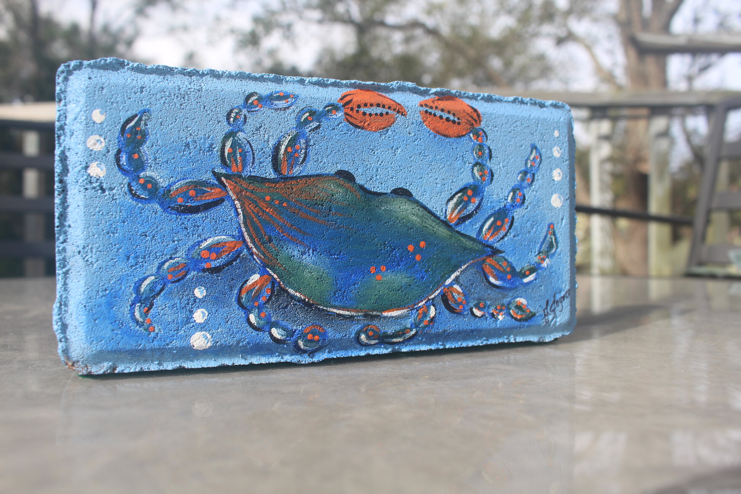
Island In the Stream

Brandon Joyner

(A Brief History of Kiawah Island)

Kiawah_Island_Golf_Resort,_Kiawah_Island,_South_Carolina.jpg

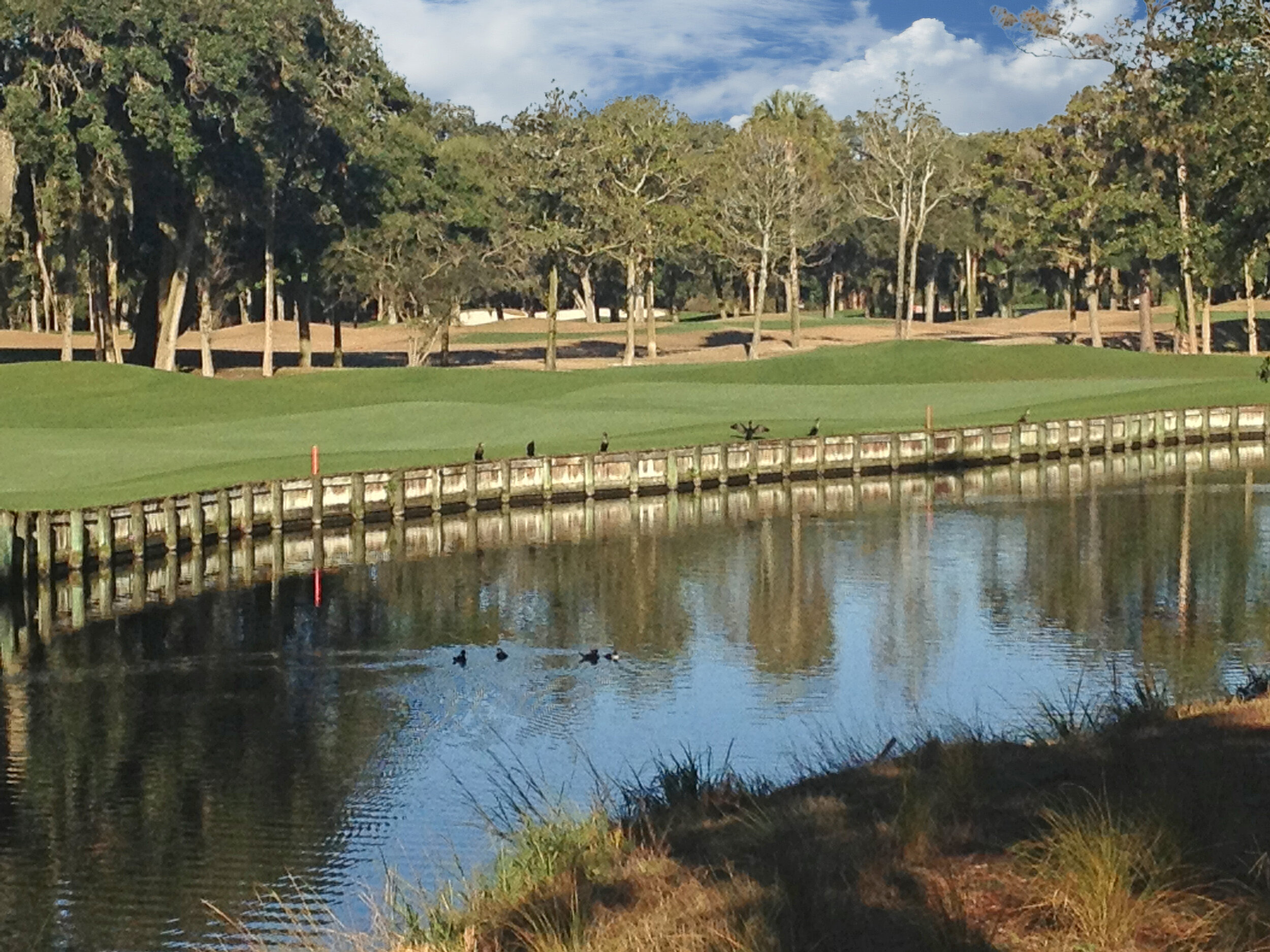
There are so many places in the Charleston area where you can slip your toes in the sand. But there are fewer where you can take a 3-Wood to whack a tiny speckled ball down an endlessly long fairway as hard as you can. From said greenway, you can view the water from the ocean lap against the shore within spitting distance as you do so.

But the serene beauty of these fairways and the surrounding area wouldn’t be located in the South if the history wasn’t sprinkled with its share of tears and heartache.

Up until the 1600s the island was home to the “Kiawah” (KEE-a-wah) Indians. Invaders carrying guns and diseases (such as small pox) eliminated those that were not held in captivity until only the name of the tribe remained. The land granted to and stolen by literal pirates of the time; the entire 10-mile island would eventually be owned by a one John Stanyarne in 1737.

Eventually turned over to the Vanderhorsts, Kiawah was owned by this famous family for over two centuries. During this period, the island saw the successful planting and harvesting of cotton, invasion by enemy armies during the Revolutionary and Civil Wars, and the eventual destruction of the family business by natural disasters and mismanagement.

One of the few memorials from that day and age is the Vanderhorst Mansion. It wasn’t added to the National Registry of Historic Places until 1974!

Fast forward to 1951. A lumberman from Georgia named C.C. Royal purchased the island for a mere $125,000. This investment paid off when the property eventually sold for over 18 million dollars to a real estate/resort developer just 20 plus years later in 1974.

In 1976, two major parts of the island opened. The Kiawah Inn (according to Kiawahisland.org) sported “two swimming pools, two restaurants and a bar.” It also included the Marsh Point golf course designed by a South African professional golfer, Gary Player, beginning a long-held tradition of the links on this gorgeous barrier island.

It wouldn’t be until the early 90s that Kiawah, in its current state, would come into focus. This was mostly due to the reevaluation of the land and surroundings after Hurricane Hugo in 1989. The bedrock of the tourism and ownership of the island would revolve around the golf courses.

Turtle Point, designed by (possibly the most famous golfer ever) Jack Nicklaus, opened in 1981, and the Tom Fazio designed Osprey Point opened in 1988. They would be joined by their sister courses, the Oak Point (designed by Clyde Johnston) and the Cougar Point (built on the original Marsh Point course and redesigned again by Gary Player) in 1997 and 1996 respectively.

But these many successes would be overshadowed by the singular success of the middle child, the Ocean Course (featured in the Legend of Bagger Vance).

The Post and Courier reported, “The Ocean Course has owned the No. 1 spot in the biennial S.C. Golf Course Ratings Panel’s Top 50 rankings at least since 2014.” This is no small feat. Designed by Pete and Alice Dye, the course was built next to the panoramic view of the Atlantic Ocean. This also adds to the mystique of the par 72 course. The strong winds blowing in from the ocean combined with the “large slopes, numerous bunkers, and challenging Bermuda grass,” it’s also been named by Gold Digest as the most difficult course in America.

During its birth year of 1991, the Ocean Course hosted the Ryder Cup. The ever-popular PGA Championship was played here in 2012, preceded by the PGA Club Professional Championship in 2005. And, in 2007, saw the Senior PGA Championship played on Kiawah. Charleston and golf fans are excited to see the Ocean Course once again host the PGA Championship in 2021.

Whether visiting with friends who own property, taking a morning on the greens or celebrating the cuisine of the master chefs working at the Sanctuary, Kiawah Island has grown to become one of the most sought-after resort destinations not only in the South or America, but the entire world as a whole.

~ Brandon L. Joyner

The Inner Light

Brandon Joyner

(A Brief History of the Sullivan’s Island Lighthouse)

Sullivans-Island-Lighthouse-dusk.jpg

There is a bit of romantic imagery that flashes to our minds when we talk about lighthouses. The history of these truly life-saving beacons has given rise to this. The reality regarding these spires is not far off the mark.

We – humanity—have moved from fires along the shore manned by families and communities waiting for our men offshore to return safely through the dark. Those bonfires are, today, a web of markers and instruments that include fixed offshore lights, buoys with bells and traditional lighthouses.

The Sullivan’s Island Lighthouse is situated on the south end of the island with the 1898 Sullivan’s Island Lifesaving Station at its base. Within walking distance, you will find Fort Moultrie and other Revolutionary War landmarks which are also a part of the National Park Service.

The lighthouse construction began in 1960 and was dedicated upon completion in 1962. The Charleston Light, the name given by the Coast Guard, was transferred from the Morris Island Lighthouse to the Sullivan’s Island Lighthouse because Morris Island’s foundation became unstable.

As our ideas have modernized, so has the look and construction of lighthouses. The new Sullivan’s Island Lighthouse design separated itself from history with its triangular-shaped, towering facility which looms over the sands of the island some 140 ft. The aforementioned Sullivan’s Island Lifesaving Station facilities are still used as maintenance and housing units for the Park Service. It’s also notable that it contains the only elevator known to exist in a lighthouse within the United States!

As noted, the building is triangular, designed by Jack Graham. Mr. Graham, a budding architect, had joined the Coast Guard and was stationed at the Washington, DC headquarters when he was tasked with designing the lighthouse.

The beam from the Lighthouse has been seen for over 50 years. The original light of 28 million candlepower was too strong – the keepers wore welding garb with filtered shields to prevent being burned. The reduced 1.2 million candle-powered light can be seen some 26 miles at sea.

Aside from its historic neighbors which have helped shape the fate of the lighthouse, the permanent residents have also shaped the use and operation of the structure. When constructed, the tower was painted with a white bottom and an orange upper portion in keeping with Coast Guard tradition. The local population petitioned and won the argument to have the upper portion repainted black. The active locals have been proponents of all the efforts to accentuate the history of the island town.

Its strength has been tested many times over the years, but none so notable as Hurricane Hugo in 1989. The winds exceeded 125 miles per hour but did not functionally damage the lighthouse. The Charleston Light is the last shore-bound light constructed in the US.

At only 60 years of age, this young lighthouse is now in retirement being passed over by technology and the changing of times. The lighthouse became a ward of the service in 2008 when it was deemed surplus by the Coast Guard.

So… If you’re ever lost at sea off the Southern Coast, look up! The Sullivan’s Island Lighthouse may just guide you home.

~ David Joyner

Sullivans-Lighthouse.jpg

The Iron Giant

Brandon Joyner

6.26 3pm Swordgate.jpg

A forge. Sparks and flame shooting forth from the impact of a heavy sledgehammer. This evokes a sense of strength of purpose. The same as that of our image of the country which we call home.

As early as the founding of this country, many have come with the desire to fulfill their dreams for health, wealth, and happiness. Christopher Werner, immigrated from Prussia—now the North Rhine—Westphalia region of Germany.

Werner was born into the family of prominent carriage builder/blacksmith, Burnhard Werner. Faced with the compulsory duty to serve in the Prussian military, Werner decided to immigrate to the United States. He set up his business in Charleston in the early 1830s and was naturalized in 1839. He quickly became known for his skills in metalwork and business. He was particularly well trained in the processes of manufacturing wrought iron and had early demonstrated his artistic and metalworking talents with the creation of many detailed pieces.

Werner, along with two other German immigrants, was determined to, ¨show what could be accomplished in Charleston in the adornment of edifices to make it worthy of the name of ´Queen city of the South.´¨ He involved himself in the remodeling of older buildings and the construction of new ones which exhibited his artwork. While moving from one address to another for these purposes, Werner maintained his foundry near State and Cumberland Streets in Charleston. Because of the quality and beauty of his work, he soon expanded his business, reaching throughout the state of South Carolina.

Due to miscommunication between the city of Charleston and Werner, two sets of gate panels were constructed. One set of the sword gates was subsequently sold to the British consul, Geroge Hopley. Mr. Hopley had bought and restored the home at the corners of Legare & Tradd Streets (32 Legare & 109 Tradd respectively). Today, this home is referred to as the Sword Gate House because of these gates.

The matching pair of gates is now prominently displayed and open to the main entrance of the Citadel campus at the foot of Huger Street.

Werner´s attention to detail and his artistic flourish made his products easily recognized for their beauty and style. He used a wrought iron snake to hang signs from the walls of his clients’ businesses. His works include the spiral and finial of Saint Matthew’s Church, numerous decorative fences and other items throughout Charleston and various locations around South Carolina. He was an entrepreneur who would invest in projects such as the Palmetto Regiment Monument (1853) on the grounds of the SC state capital. It is a palmetto tree, notable for its size and detail, leaving many to remark about its realistic appearance. Made without commission, Werner speculated that its significance would elicit payment from the state to compensate him for the project. He only realized $5,000 from the state for his $11,000 investment.

Werner's productivity and popularity are evidenced by the number of his works seen throughout the city. It is quite fitting that Werner's final constructed piece of ironwork is the giant filigreed cross and stanchion marking his burial site. Although his body may be laid to rest, his monumental giants will withstand the tests of time

~ David Joyner

Pinch Me

Brandon Joyner

A Brief History of the Atlantic-Blue Crab

IMG_9347.JPG

The Atlantic Blue Crab—species: Callinectes sapidus—regionally called the Chesapeake blue crab, named as such due to the bright-blue claws and olive-brown mottled shell (carapace). Crabs molt approximately 25 times until they reach full maturity as their exoskeleton doesn’t expand and grows underneath the shell until it’s shed. The exoskeleton remains soft for a small period of time and that is when the much-beloved soft-shelled crabs can be harvested (between 3.5-6 inches). Adult female blues have a red tip at the end of the claws and are slightly smaller than their fully-grown adult male counterparts, which can get up to 8 inches across on average. The largest on record was just under 11 inches measured across the back from tip to tip!

This species of crab is native to a wide range of waters—from the Nova Scotia bays of the western Atlantic Ocean to the coasts of South Carolina, into the Gulf of Mexico and even as far south as Argentina. The Atlantic Blue Crab has been introduced internationally largely due to their fifth pair of paddle-like legs; they are extremely strong swimmers! These blue beauties inhabit estuaries and brackish coastal lagoons. Because of their ability to adapt to fresh and salt, clean and dirty waters, it’s likely that the Blue Crab has been in existence for more than a million years; though, the average life-span of a single crab is only 3 years!

Females reach maturity at 1 year of age and only mate once in their lives. On average, a “she-crab” will release 2 million eggs at a time. This spongy roe found under the apron of the female crab is the main component in traditional Charleston She-Crab Soup. Blue Crabs live up to their namesake, which means “savory beautiful swimmer,” are well-harvested and enjoyed in many recipes due to their sweet tender meat. Notably, 1 cup of cooked Blue Crab boasts much nutritional value with only 112 Calories and 1 g of Fat, packing in 24 g of Protein and 350 mg of Potassium. They feed not only the body but are a large contributor to the local fisheries here in Charleston.

These crabs feed on pretty much anything they can wrap their pinchers around, including much sea life: snails, mussels, plants, fish, and even smaller blue crabs if they can’t find anything else. They help maintain population control of the things they feast on. Their predators include: us, sea turtles, whooping cranes, herons, larger fish, older crabs, and as the larvae are fully forming, some smaller fish and jellyfish will nosh on them.

If you would like to adopt a Blue Crab rather than feasting on them, The National Wildlife Federation will even allow you to do so.

In whatever form you might fancy your crabs—they can be appreciated in all stages of their lifecycle—from the beautiful blue swimmers in the oceans to the delicacy of combining ingredients and being prepared for consumption, they truly boast a bountiful harvest which can be enjoyed by all!

~ Kristen N. Granet

Diary of a Shrimpy Kid

Brandon Joyner

(A Brief History of Shrimp in Charleston)

4.24 Shrimp Boil.jpg

We could start everything with a couple of corny jokes. We could ask, “Where do shrimp sleep?” Then let you know, “In a water bed.”

Or ask, “What do shrimp need to stay healthy?” Answer? “Vitamin Sea.” But we won’t do that. For your sake and ours.

What we will do is inform you that there are over 300 different species of shrimp populating the seas. While we could spend pages and pages (and many have) discussing the many different types of shrimp, let’s stick to the local waters of South Carolina where certain shrimp and all of Charleston calls home.

There are three types of savory shrimp that populate the waters of our coast: brown, white and pink. The former, brown and white shrimp, are far more common.

In May or June, predominately you have what’s called roe shrimp; roe being the fertilized external egg mass from the shrimp. The Department of Natural Resources monitors the local growth and advises if there’s sufficient quantity to produce a full harvest. This part of the season is the shortest coming in at only about a month long.

Brown shrimp season makes up the second season. This generally runs for a few months starting in June and ending sometime in August. The brown shrimp – they go great in Cajun food like jambalaya due to their strong flavor profile – are some of the most common shrimp species. They can be identified by their red or brown color that is most greatly pronounced in their tails.

Milder than their cousins, the white shrimp are not unlike most of what comes out of the South: very sweet. The largest group harvested for food, the white shrimp season overlaps with the brown and can last until early January. If you’re picking up frozen shrimp in the freezer section of your local grocer, chances are they are of the white shrimp ilk.

Put on some Barry White and turn down the lights… ‘cause a single female produces between 500,000 and 1,000,000 eggs and can go through this process several times. The male then fertilizes the eggs and they sink to the ocean depths until the time and tide literally bring them up and they hatch. But “less than one or two percent of the eggs spawned survive to adults” according to the South Carolina Department of Natural Resources.

As far as what shrimp eat, they are simply bottom-feeders. Larger shrimp may feed off worms, small fish and even some crabs, but most simply feed off teeny tiny animals and plants also found on the ocean floors.

Speaking of food… While we could spend time writing another book or two on how the shrimp move from the proverbial saltwater—farm to table, let’s instead focus on the delicious magic that transpires once those crustaceans hit the plate.

You can enjoy them fresh. Many restaurants will simply boil these mouthwatering morsels. Peel. Eat. (Maybe dip in cocktail sauce.) Enjoy.  If you’re feeling frisky, you can grill or fry up a pound. Just add a dip: tarter or the classic cocktail, again.

Shrimp are the main ingredient in a Lowcountry Boil, alongside corn, sausage, and potatoes. Then there’s the Charleston staple of Shrimp & Grits... Just make sure that you get the right chef. While these dishes might seem simple, they’re like potato salad at a picnic: buyer beware! There must be a proverbial, hyperbolic billion ways to prepare shrimp that will tickle your palate from Charleston to New Orleans, everywhere in the South, and in between.

So, just remember, next time you have a huge pile of shrimp on your plate, share. Don’t be… Shellfish? (We couldn’t resist.)

The Not-So-Secret Gardens

Brandon Joyner

(A Brief History of Magnolia Gardens)

Charleston_South_Carolina-Short_white_bridge_in_Magnolia_Plantation_and_Gardens-20060429112230.jpg

Who said it isn’t fun going to a museum? And we’re not talking about Ben Stiller at night.

If you head down Ashley River Road away from West Ashley toward Summerville, you’ll be blessed to find what seems to be a never-ending canopy of the most beautiful trees you can imagine.

It seems to lead on for miles. (Mostly because it does.) If you turn right as the signage leading to Magnolia Gardens advises, you’ll be greeted by a landscape out of the movies. Green and lush, epic and stately.

Simple fact: Magnolia Gardens is one of the oldest Plantations in the South. But, what’s the history of the original 1,872 acres that make up this former Plantation?

Thomas and Ann Drayton (yes, the same Draytons of Drayton Hall) decided to build a small home with a garden. They received this from Steven Fox (Ann’s father) after he purchased it from Morris Matthews - one of the earliest settlers in the area - who received a warrant for 750 acres of land.

But their plans wouldn’t be satisfied with that. Over the next 175 years, the desires of the family would grow and encapsulate rice farming. During the Colonial Period, South Carolina was the largest producer of rice in America.

There is a dark and malevolent past within the gates of the grounds as with all of those types of businesses in the South at this point. There were upwards of 325 enslaved peoples working the property to keep the wheels of the pre-industrial America turning. Most were brought in chains from Barbados to work the extensive rice fields.

The African slaves empowered themselves in the best way they knew how by creating a new form of communication—a creolized language. The Gullah and Geechee heritage still thrives here and if you ever want to hear a shout from the past, just ask someone fluent in these languages to share them with your ears.

Shedding the literal shackles of its past, Magnolia went through a transformation in the 1840s. Reverend John Grimke-Drayton inherited the property and wanted to do something special with the land that might not be tied to the soon to be outdated thought processes of enslavement. His horticultural genius would move the camellia out of doors and introduce the azalea to America.

Even though the property and its owners were attempting to move away from its controversial past, it couldn’t separate itself from its actual location. During the Civil War, the original plantation home was burned and most of the property was destroyed. With the loss of the War and the steep economic downturn in all of the Southern American states, John Drayton was forced to sell most of his land just to save some of it.

The property has dwindled to the 390 acres that make up the estate today. It still remains within the control of the Drayton Family after over fifteen generations. But, due to the foresight of John Drayton, the ornamental wholesale plant nursery keeps the lights on and the doors open to this day.

Where to begin with all of the activities that represent that sprawling landscape that is Magnolia?

There are seven bridges on the grounds; most notably the Long Bridge. A Wildlife Refuge where you can wander with some of the more common nonfatal fauna. But, don’t worry about those from the Lowcountry that might want to eat you. They’re safely tucked away in the Zoo area. Also worthy of mention are the replica of England’s Hampton Court Maze and the Barbados Indoor Tropical Garden.

It wouldn’t be part of the Holy City without something from the Bible being referenced. The Biblical Garden has areas where the Old and New Testaments are referenced through the plants that adorn the area.

While some museums represent the bones from a past long forgotten, others - like Magnolia Gardens - are a place where everyone can interact and experience history first-hand.

~ Brandon L. Joyner

A Tip of the Hat, Man

Brandon Joyner

20190718_005243.jpg

(A Brief History of the Hat Man)

Banksy once said – and we’re paraphrasing – Graffiti is one of the few tools you have if you have almost nothing. And even if you don't come up with a picture to cure world poverty you can make someone smile while they're having a wee.

In short, what makes you happy AND pay a little bit of attention?

Charleston has always been known for its sharp-dressed men and women. But where do these people shop? And how did they find out about that place to begin with?

It isn't surprising that this history involves a well-placed address with a significant piece of architecture and a varied background. Some would say that such a structure would be severely affected by common graffiti, but that doesn't seem to be the case for the Penge building at the corner of Broad and Church Streets.

Construction of the structure was initiated in 1855 by Charles Love and Conrad Wienges for their service to the “carriage” trade—saddlery and harnesses. The sale to Charles Plenge in 1855 brought a change to the clientele—from horses to people. At some point in the ensuing years, Mister Plenge’s Haberdashery was sold to one of his employees, A. Beauregard Betancourt Sr. Today the building has been renovated and restored with a multiple-use designation having offices on the ground floor and stylish Apartments upstairs. Notably, it still maintains the original Plenge facade.

So, how does graffiti fit in? Well, the most well-known name for the building is a “Hat Man Building.” For over 100 years, everyone walking past might have noticed the hand-painted figure on the Church Street side of the building that gives its name to the structure.

Legend has it that Mr. Betancourt was something of a cartoonist known for his hand-drawn figures. Sometime around 1892, the hand-painted figure of a man appeared on the side of his clothing business. It was noted then as a perfect advertisement for the shop which served all of Charleston's most notable and well-dressed businessmen. The haberdashery was known for hand-tailored suits and appropriate hat wear. The later became the inspiration for Mr. Betancourt's painting of the Hat Man on the side of his store.

The colors of the painting of changed ever so slightly over the century yet it continues to intrigue passers-by. This artwork is comprised almost entirely of hats, at least 12 styles of them—from the top hat on his head to his ears made up of two different styles of soldier’s hats to the sailor caps as shoes on his feet.

It doesn't seem to have mattered beyond the normal Charleston concern for architecture, but since Mr. Betancourt died 1944 his now-famous painting has been lovingly preserved by those involved with historic preservation.

While you may not be able to top off the night with a stylish bowler or crown yourself with a fancy fedora at this particular location, the Hat Man is a reminder of our thick Charleston history and how we should always look our best.

Or should we say the bee’s knees? Beau Brummel? The cat’s pajamas? You’ll just have to cap this one off for yourselves.

~ David Joyner and Kristen N. Granet

Meanwhile, Back at the (Randolph) Hall of Justice…

Brandon Joyner

(A Brief History of Randolf Hall)

Randolph Hall.jpg

Ask what is distinctive about the College of Charleston and the majority of responses will mention Randolph Hall at the Cistern on the main campus. “It's that building with a double staircase up the front.”

Randolph Hall is proudly situated on the original campus as the architectural face of the college and has the distinction of being the oldest of the three structures at the heart of the campus. It also was the first constructed for the purpose of teaching. Architect William Strickland designed the hall and saw it completed in 1829. It was enlarged in 1850 as part of a campus expansion at the direction of the architect EB White who added the six columns that make its facade so notable.

The Cistern, which sits in front of the hall, was completed in 1857 for flood control and water supply for firefighting. The cistern yard has Porter’s Lodge (1850) and the Towell Library (1850) named after its 1934 alumnus, EB Towell. The walled area around the cistern is known for the college graduation ceremonies taking place on Mother's Day. Over the years the commence exercises have utilized walkways over the cistern and the double staircase on the face of Randolph Hall for the processional of students receiving their diplomas.

The college has grown from an all-male class of 6 in 1794 to more than 10,000 including all races and genders. Randolph Hall has had a number of changes to its structure – both by design and by disaster. The whole by virtue of its longevity and physical integrity reflects the efforts of its namesake, College President Harrison Randolph -- who served the school for 48 years from 1897 - 1945. During his tenure, Randolph began the modern building program that has seen The College grow to more than 100 structures. His presidency opened the doors for the first time to women (13 in total) in 1918. Randolph managed the municipal college with just the tuition of students, alumni donations and City of Charleston funding.

Today, The College of Charleston has transitioned to be part of the state higher education system as a highly regarded liberal arts and science college. It still retains its historic stature as the oldest college south of Virginia and the 13th oldest in the United States.

The class membership. The columns and stones. The deep-rooted educational context of the building and surrounding buildings. Regardless of all the history and architecture, the most impressive view of Randolph Hall is from the seats placed inside the Cistern Yard that enable a parent to proudly watch as their graduate receives their diploma as reward for hard work and perseverance.

~ David Joyner

Get To the Point

Brandon Joyner

(A Brief History of White Point Garden)

IMG_7969.JPG

Living in a city like Charleston you develop a very strong appreciation for history, particularly local history. Everywhere you go there are reminders to tell you who did what, when, where, and why -- and sometimes how.

Let's start at the most obvious point on the city’s map—White Point Garden. When you climb the Battery wall (promenade) and look toward the ocean, you will see a number of known historic sites. Fort Sumter, Fort Moultrie, Castle Pinckney, Sullivan's Island, and the USS Yorktown are the most notable visible sites to see.

Oyster Point (now White Point) is the first place seen by the original settlers and those who brought them. Because of the bleached white oyster shells dumped at this point, both names have been used for the entirety of the park behind the Point. As early as the 1720s, Charles Towne officials and maritime defenders had captured and hung many of the pirates and their crews that populate the Romantic history of that day (as can be read about in our blog-- Fully Charged: A Brief History of the Battery).

The great hurricanes of 1724 and 1752 left the White Point area desolate, destroying both landscape and housing. It was during this period that the Point began to develop with the addition of a “log “seawall to protect the new elegant homes. Charleston’s well-to-do decided to build upon the newly filled low spots along the point. The hurricane of 1804 took out the seawall of log which was replaced with a wall of ballast stone. This new wall allowed the park to develop over the next Century of public space used for all sorts of events that endured the “park” (White Point Park) to Charleston.

Over the three centuries of White Point Garden’s existence, numerous pieces were added. During the Revolutionary War as fortifications were built, various “cannons” were placed to aid in that effort. The same was true during the Civil War as the Confederate troops attempted to hold Charleston as Union troops persisted in their effort to lay siege. Other cannon and mortars were put in place and remain there to this day.

The Monuments that dot the greenspace vary in time from that which recognized the contribution of Major General William Moultrie from the Revolutionary War, to the Confederate Memorial for those who defended Charleston, to the memorial of those who died aboard the USS Amberjack, SS219 on March 22nd, 1943—73 crewmen were aboard when the submarine was sunk by Japanese gunboats.

The most obvious structure by size in the area is the White Point Garden Bandstand which was donated to the city in 1907 by Mrs. Martha Covington as a memorial to her parents, Mr. and Mrs. George Wilson Williams. The Williams family were the original owners of the well-known Calhoun mansion on Meeting Street just four blocks from White Point Garden. Mrs. Carrington and family-owned and resided at number two Meeting Street—now the famous to Meeting Street Inn. These homes are just two of the significant (structurally and historically) homes that line the battery and adjoin White Point.

White Point Garden was yesterday and is today Charleston's Premier outdoor area to take in Charleston's beauty and history. Our hope is that nothing will change that gracious, welcoming image to our charming city for many years to come.

~ David Joyner

In the Jailhouse Now

Brandon Joyner

A Brief History of Charleston’s Old City Jail

20190718_004205.jpg

For the bulk of America’s population, the idea of visiting a jail creates a very broad spectrum of emotion— from curiosity to horror. The “Old Jail” of Charleston elicits all of those emotions because of the reality and folklore that surrounds it. As noted by frequent visitors of Charleston (Michal and Lin Easton of Hendersonville, NC): “...the Southern air was alive and well, but... inside these walls [it] was truly the last breath of so many from years before.”

Reality, of necessity, is tied to the origin and use of the jail as well as the design, construction, and multiple renovations required by the several acts of God visited upon this edifice.

The Charleston district jail was built in 1802 and served the district until 1939 and housed many inmates from various walks of life over the years. A four-acre site, a portion of which was allotted for the Old Jail, was designated by the City of Charleston for public use. It also included space for a hospital, a poorhouse, and a work house for runaway slaves.

The original structure was four stories tall with a two-story octagonal tower. Later renovations and reconstructions included: a rear octagonal wing, expansions to the main building, and the Romanesque revival details. The fireproof wing, designed in 1822 by Robert Mills, was replaced by Barbot & Seyle’s designs. The earthquake of 1886 caused the removal of the badly damaged tower and top-story of the main building. All that remains today are the three stories. However, it is noted that Bulldog Tours (who currently guides guests on haunted visits) will be contributing a large amount toward the reconstruction of the Old Jail.

Some of Charleston’s most infamous criminals & Civil War Federal Prisoners of War called this “home.” “Notable” inmates included: Stede Bonnet and his crew (1718), John & Lavinia Fisher (1819-1820), some of the final remaining sea pirates (1821), and Denmark Vessey (1822). Of these, the most vicious was Lavinia. She was the first female serial killer in the United States. To this day, she is said to be roaming the halls of the Old Jail as her famous last words were: “If you have a message for the Devil, tell me and I’ll deliver it myself.”

When you look at the face of the building it drives home the fact that people have been there and heard things... voices... screams; seen things move... felt the cool breezes rush over them... or even had the hairs on the back of their necks tingle! As one tours the building, the realization that thousands of inmates died within these walls, the idea that some of their spirits remain, easily leads one to wonder whether what they heard or felt or thought they saw just might be one of those lingering souls.

~ David Joyner

Fully Charged

Brandon Joyner

A Brief History of The Battery

IMG_7952.JPG

Charleston has many historical landmarks and as you venture through our wonderful city, you will see most of them. Though you might not realize the exact history behind it, the Battery is one of these intrinsic points of Charleston history.

When the settlers first sailed into what is now Charleston Harbor, looking for a place to land, they passed the tip of the peninsula and landed at Albermarle Point down the Ashley River in 1670. By 1678, it had become obvious that the point that they had passed was the most suitable for a protected settlement. Oyster Point was the name given because the Indians had dumped all of the waste oysters at that point in the area above the low water mark where the Cooper and Ashley Rivers converged.

Colonel William Sayle, the first governor, noted about the area, “It is as it were a KEY to open and shutt this settlement into safety or danger,” in his letter to Lord Ashley, the lord’s proprietor. Defensive positions began to be established to fight off the pirates of that day. In 1718, the notorious Edward Teach, better known as Blackbeard, blockaded Charleston Harbor in order to blackmail the royal governor for medical supplies. Blackbeard threatened execution of a number of prominent citizens he had captured. The governor complied and the citizens were released. Getting no response from the lord’s proprietors when asked for assistance, the local merchants banded together with William Rhett as their commander. Capturing Stede Bonnett, the gentleman pirate, they brought him to Charleston to be tried. His crew was first to be sentenced to be hanged. This hanging took place on the limbs of the Grand Oak Trees which fronted along the Battery. On November 8th they were left hanging for days with the expectation that their captain would soon join them. Due to Stede’s pleading, his trial was delayed 7 times. Bonnett was ultimately hung on December 10th, 1718 at the White Point portion of the Battery.

The Battery has seen attempts to capture Charleston throughout the years from the Revolutionary War to the Civil War. As a result, there are many fortifications from Water Street around the point and back to the foot of King Street. During the Revolutionary War, those fortifications included Colleton Bastion at Water and Meeting Streets, Broughton and Fort Wilkins at Oyster Point, and Gibbes Fort at the foot of King Street.  Battery Ramsey occupied White Point Garden during the Civil War.  Even though the city of Charleston does not recognize the Battery Park or White Point Garden as “official designations,” the citizens of Charleston will always direct you to “The Battery” if you should ask for directions to either of those destinations.

As the City of Charleston continued to grow and develop, the seawall at Oyster Point was built first using large tree trunks. Along that portion of the Battery from Water Street to the point. One of Charleston’s early hurricanes washed the wall away. It was later replaced with a rock wall that became the foundation for the Battery that we know today.

Along both Murray Boulevard and East Bay Street, you will find glorious homes of great distinction and architectural design. They vary from the simple Row House structures on Murray to the very large mansions of East Bay along High Battery. Looking out across the harbor away from those homes, one can see Charleston´s new Ravenel Bridge, Patriot´s Points´ U.S.S. Yorktown, Castle Pinckney, Fort Sumter, and James Island.

Today, the Battery has been developed into a grand promenade. Both High and Low Battery now run from Chalmers Street, around the point, and down the length of Murray Boulevard. This thoroughfare sees countless pedestrian and vehicle traffic on both the seawall’s sidewalk and the avenues that are considered to be Charleston’s Battery. If you haven´t visited this spot in Charleston yet, you’re in for a real visual treat!

~ David Joyner

See How the Main Sail Sets

Brandon Joyner

(A Brief History of Charlestowne Landing)

1910140_511247693574_4353_n.jpg

We all have the privilege of being part of history. Not so much because we have created some new invention, medicine or social algorithm that brings happiness to everyone but because we just happen to be where we are when we are.

Real historians like to populate their writing and oral dissertations with items of real information shared by one or two people and sometimes groups who shared similar ideas and goals.

On the 300th anniversary of the founding of Charleston (1970)--  Charles Towne Landing was created as a tribute to the land originally founded by the English colonists who left England for a brighter, free-er life for themselves and their progeny.

The first Carolina settlers landed at Albemarle Point - west of the Ashley River -  just across and south of the peninsula that would later become Charles Towne (1680); Charles City (1729) and finally Charleston (1741).

An impressive 604-acre site, Charles Towne Landing, has remained open as a Parks and Recreation facility operated by the state and by local authorities since its opening in 1970. It has seen many changes and improvements over its lifetime including the removal of the original meeting facility-- a geodesic dome – which was used for various functions. The pavilion has seen modifications over the years with the goal to increase its public desirability.

The nature trail has always been popular with visitors who try their best to view the animals from the elevated walkways that traverse the habitat.

One of the other very popular facilities located at Charles Towne landing is the Legare-Waring House which reflects the style of many of the buildings throughout the Lowcountry-- whether in downtown Charleston or on many of the plantations. You can't come away from Charles Towne landing without visiting their tall-ship, “The Adventure.” The current model - like its predecessor – is a replica of a 17th century ketch that plied Charleston Harbor. From its maritime beginnings, it hauled all sorts of cargo and passengers. It is a traditionally rigged vessel with two masts - the main and the mizzen - with the mainsail being forward and the mizzenmast being amidships (in the middle). Some had a lower boom that allowed it to be used as a crane for loading or unloading cargo. The main mast exceeded 40 feet in height which resulted in the nickname of “tall ship.”

There are multiple designs of tall ships that will fill picture books with visions of days gone by and history being made, but you don't have to go far in Charleston to actually feel the excitement of being part of the founders’ history or the thrill of being at sea on a ship that is still making history with every visit.

~ David Joyner

All the (Good) News That’s Fit to Print

Brandon Joyner

(A Brief History of St. Michael’s Church)

As you drive through downtown Charleston, as a resident or visitor, you have to wonder—how did they find the space to build so many churches? It would be easy to conclude that all the original colonists must have been refuges from the Spanish Inquisition, the French Revolution or the English Reformation of the Anglican Church!

Charleston's earliest settlers built a simple wooden church at the corner of King and Broad Streets. The St. Phillips’ congregation started their services there in the early 1680s. As the town grew with the arrival of others from all over Europe, the small church could no longer house the congregation, so they built a large brick church on Church Street just four blocks away. The other property was then available for the St. Michael’s congregation to build on the King and Broad site in 1752. This opened in 1761 for services as directed by the South Carolina General Assembly.

St. Michael’s Church has remained virtually the same from that day until now except for the addition of the sacristy in 1883. The interior design of St. Michael’s is set according to the Book of Common Prayer. This puts the church on a very short list of those holding to that standard presently.

From the beginning, St. Michael’s church was a formidable edifice. The steeple was originally 193 1/2 feet in height until the 1886 earthquake caused it to sink eight inches. Inside the church there are almost too many significant pieces of art and architecture to take in with just one visit. The original chandelier, imported from London in 1803, was fitted with candles and is now, for safety’s sake, electrified. The pulpit is original to Saint Michaels and is notable for its height and its structure. The central panel on the face of the pulpit with the religious insignia was looted after the Civil War, but luckily it was later voluntarily returned. There are scars in the woodwork from the wartime bombardment of 1865. The Victorian Alter (1882), the Chancel Chairs in the vestry (1887) and the wrought iron chain rail (1772) all represent remarkable historic enhancements to not only St. Michael’s but also to Charleston.

It's impossible to conclude a visit during a service or a guided tour without paying particular attention to the gorgeous stained-glass windows and door. “Easter Morning” and “The Annunciation” were gifted to the church in 1897 and 1908 respectively. The door was a gift in 1915. The long-term restoration and preservation of the windows was completed as part of St. Michael’s 250th Anniversary Celebration.

The sounds of St. Michael’s are significant because of the Snetzler Organ installed in 1768 and restored and refurbished in 1994 by Kenneth Jones of Bray, Ireland; add to that the clock and ring of eight bells imported in 1764. All of these instruments provide the congregation and Charleston’s citizens and visitors with its hourly peel and the beautiful choral music accompanied by the magnificent organ.

It would be so easy to continue the conversation about St. Michael’s church because its history is so deep. And just think, we haven't even talked religion or politics!

~ David Joyner

Pen Pineapple (Fountain) Apple Pen

Brandon Joyner

(A Brief History of The Pineapple Fountain)

61796679_2288101934782616_5735099040421380096_n.jpg

Charleston's history and charm are both very real on a stroll through its streets and alleyways. Its sights and sounds remind us of the “then and now.” The living history of Charleston is a large part of its charm—horses’ hooves clip-clopping on cobblestone streets, carriages used for sightseeing and the lapping of waves against the city shoreline. The smells of the salt air and the pluff mud of our marshes adds to that charm. The draw of all that pulls us to the waterfront where the current remnants of the maritime industry can be seen from many points along the battery and the side streets of East Bay.

At the Vendue Range end of Waterfront Park is the iconic Pineapple Fountain which represents -- for native and visitors alike -- the warm welcome and obvious hospitality of many a Charlestonian.

The Pineapple Fountain has stood tall on the waterfront since it was open to the public in May of 1990. It took a lot of planning, preparation, and prodding to launch and complete this elegant sign of Charleston’s hospitality.

Union Pier all the way down to the fancy house used to be just a bunch of burned out pilings of warehouse remains from the 1950’s. In the late 80's, Mayor Joe Riley created a rejuvenation plan. The Pineapple Fountain was part of this shoreline revamp for the areas of Charleston that would be on display and prominently seen by all.

But this wasn’t executed until almost a decade later.

The biggest question: Why a pineapple? Accepted legend has it that many of the captains of maritime day gone by would announce their return by the placement of a pineapple upon the front fence post. This signified not only their return but also their intent to share the stories of their adventures during the voyage. The use of such curious cargo was a reflection of where they had been and much of what they had experienced.

One of the most desired viewing spots is Charleston’s Waterfront Park. It allows our friends and visitors the opportunity to take leisurely strolls with their families through the quarter-mile length of the park. One can enjoy a quiet space on the greenway amidst the trees or a calming repose on the large sets of swings under the canopy next to the river. You might also wave to your friends taking one of the many river tours or out testing their skills in a sailboat.

Pineapples are a global sign of peace and hospitality and this is Charleston’s way of welcoming all!

~ David Joyner

(Photo Cred: Kristen Granet)

Taste the Rainbow (Row)

Brandon Joyner

(A Brief History of Rainbow Row)

20181128_163157.jpg

If you were to ask a native Charlestonian about Rainbow Row (i.e., What is it?, Where is it ?, Etc.) your answers would be pretty much the same from them all. We all know something about the pretty pastel houses lined up along East Bay Street, south of Broad Street. You might get some personal answers like – “they have been there as long as I remember” or “that their colors never change.” These bits and pieces are true as far as they go, but you would be missing what Paul Harvey would call – “the rest of the story.”

The houses of Rainbow Row were built between 1748 and 1845 along the riverfront as commercial units with living space on the second and third floors. Over the course of their existence, these houses from 79 to 107 East Bay Street have seen prosperity and recession; wind, rain and storm; and most notably massive damage from hurricanes, fires and earthquakes. Through all of these misfortunes, the “Row” has stood due in part to the resilience of their individual owners, but mostly due to the overall sense of community that pressed for their rebuilding, repair, or renovation.

These homes have been the property of many Charleston notables and their families as well as those who came to visit and never left. This collage of personalities saw the “Row” through the early years of new industry and growth as well as the years of war and sorrow. They also brought the row from economic success to the drab darkness of decay. Compounded by Charleston’s famous fires and earthquakes, Rainbow Row fell to its lowest point in the early 1900s when it was seen as the slum of the “east-side.”

Not wanting visitors or residents to take this visage as a lasting impression of Charleston, several of Charleston’s ablest citizens took it upon themselves to change the “Rows’” image. Starting with Susan Pringle Frost’s purchase of several of the houses beginning in 1920 and subsequent purchases by Lionel and Dorothy Legge in 1931 and John McGowan in 1938, the properties from 79 to 107 East Bay were restored, rebuilt or renovated to the “glory” that is theirs today. When Justice and Mrs. Legge purchased 99/101 East Bay for restoration, Mrs. Legge decided on the Caribbean Pink exterior to help cool the house during the Charleston summers, not necessarily so people could tell which one was theirs. The other owner followed suit with pastel colors of their own choosing thus giving us what today is referred to fondly as Charleston’s Rainbow Row.

The effect of their transformation resulted in the Charleston Society for Preservation of Old Homes, later to be known as Charleston’s Preservation Society. Along with the influence of the Charleston Historical Society, other parts of Charleston became targets for renewal and restoration followed by adaptation of local legal codes. These codes guided not only the restoration of Charleston’s neighborhoods, but also the building of new properties so that they would not detract from Charleston’s unique historical look and feel.

These thirteen homes on East Bay Street have stood the test of time to become the longest row of Georgian style architecture in the country. “Rainbow Row” is a beacon of its citizens’ strength when faced with adversity and as part of Charleston is reflective of the city's grace and style.

~ David Joyner